 |
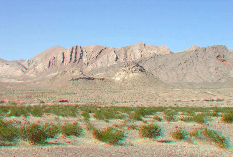
This view from along the Northshore Road near milepost 17 is looking north across Callville Wash. Creosote bush dominates the landscape of the lowland pediments and alluvial fans throughout the park region. Callville Wash drains the southern end of the Bitter Springs Valley near the area known as the Bowl of Fire. The rugged landscape in the distance is associated with the Lake Mead Shear Zone (and fault system) that runs in a roughly northeast to southwest direction along the north side of the Bitter Springs Valley and the Gale Hills along the northwestern border of the park (see the geologic map to see the location of the shear zones)(Tingley and others, 2001; Beard and others, 2007). |