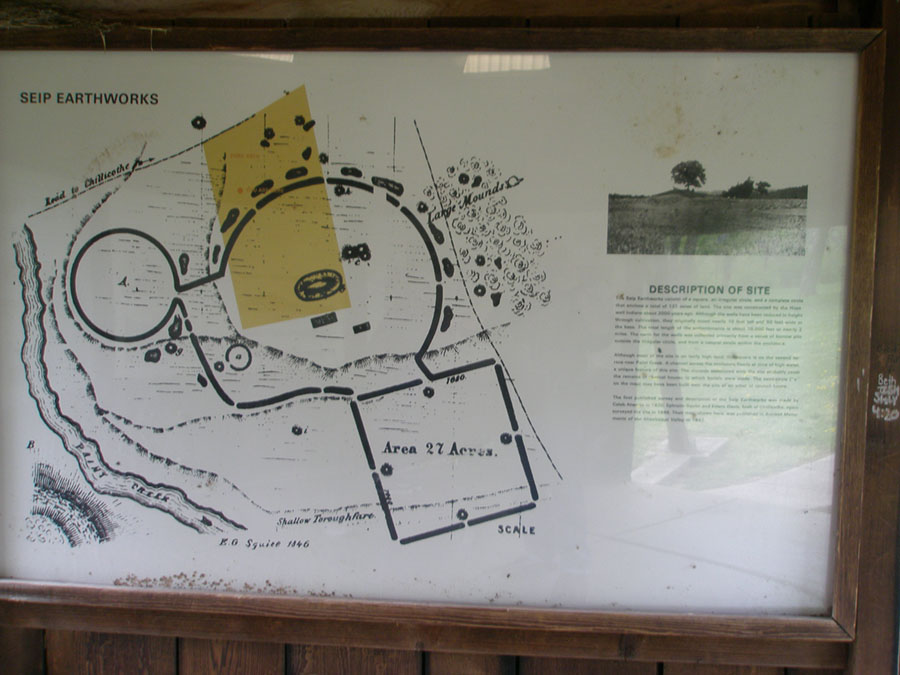
DESCRIPTION OF SITE
The Seip Earthworks consist of a square, and irregular circle, and a complete circle that encloses a total of 121 acres of land. The site was constructed by the Hopewell Indians about 2000 years ago. Although the walls have been reduced in height through cultivation, they originally stood nearly 10 feet tall and 50 feet wide at the base. The total length of the earthworks is about 10,000 feet or nearly 2 miles. The earth for the walls was collected primarily from a series of borrow pits outside the irregular circle and from a small swale within the enclosure.
Although most of the site is on fairly high land, the square is on the second terrace near Paint Creek. A channel across the enclosure floods a time of high water, a unique feature of this site. The mounds associated with the site probably cover the remains of charnel houses in which burial were made. The semi circle (a on the map) may have been built over the site in an arbor or council house.
The first published survey and description of the Seip Earthworks was made by Caleb Atwater in 1820. Ephrain Squier and Edwin Davis, both of Chillicothe again surveyed the site in 1846. Their map shown here, was published in Ancient Monuments of the Mississippi Valley in 1847. The map comes from a plate drawing in Ancient Monuments of the Mississippi Valley 1847." [See references].