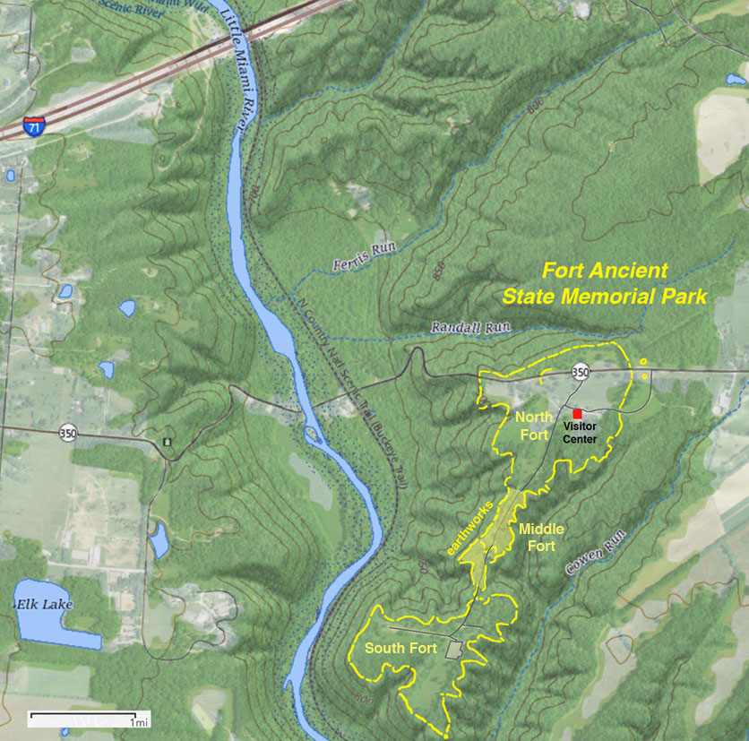
The park is located near Lebanon, Ohio along Route 350 near Interstate 71 between Cincinnati and Columbus in Warren County, Ohio.
|
| Map showing the extent of the earthworks at Fort Ancient State Memorial Park, Ohio. Yellow lines on the map show the extent of the ancient earthworks of this Hopewell culture site (also described as Adena and/or Late Woodlands culture). Fort-like earthworks border hilltops along eastern side of the Little Miami River valley in southeastern Ohio. Archeological studies sugest that the earth walls were built over a period of about four hundred years and used for another couple hundred years after that. The South Fort was constructed first, then the Middle Fort. The North Fort was built last approximately between 1 A.D. to 200 A.D. The park is located near Lebanon, Ohio along Route 350 near Interstate 71 between Cincinnati and Columbus in Warren County, Ohio. |