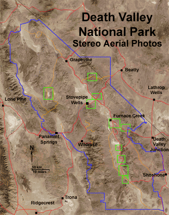
Click on any of the green boxes to see a stereo aerial view taken in 1948. Click here to see all the images in series. Scale on all images is about 1 inch equals a mile (1:48,000); north is to the left; elevation is highly exaggerated by stereoscopic effect (converted to anaglyph, requiring 3D red-and-cyan glasses for viewing). To see these images as regular aerial photographs, click here.
Click "next image" to start a 3D aerial photo tour.
For a larger view of this map, click here.