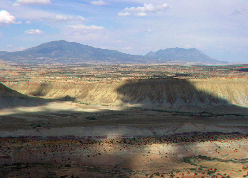
| Afternoon clouds make for dramatic landscape color changes. This zoom
view from the Strike Valley Overlook provides a more detailed view of
the Upper Jurassic and Cretaceous section, and of the Henry Mountains
in the distance. Across the bottom of the image are the brown and gray
beds of the San Rafael Group. The top of the San Rafael Group is the gray,
slope-forming sandy shale of the Curtis and Summerville Formations, which is in turn overlain
by the conglomeratic sandstone of the Salt Wash Member of the Morrison Formation.
In the shade of clouds across the lower center of the image is the barren purple
and gray shale of the Brushy Basin Shale Member of the
Morrison Formation. The rest of the section up to and including the caprock rim on
Tarantula Mesa is Mancos Shale. The caprock sandstone on Tarantual Mesa is
Mesaverde Formation (see stratigraphy by Morris and others, 2000). The Henry Mountains (in the distance) were one of the last recognized and named mountain ranges in the United States; the mountain cores consist of intrusive igneous rocks (laccoliths) of Tertiary age (Gilbert, 1880). Radiometric ages derived from the igneous rocks suggest that the intrusion in the region formed from 31.2 to 23.3 million years ago (late Oligocene) (Friedman and Huffman, Jr., 1997). |