Regional Geology of North America |
|
Rocky Mountains Provinces |
Click on images for a
larger view. |
| The Rocky Mountains are subdivided into three provinces: The Northern Rocky Mountains (Montana and western Canada), Wyoming Ranges and Basins (or Central Rockies), and the Southern Rocky Mountains (Colorado and New Mexico).
Starting in Miocene time, the entire Western Great Plains and Rocky Mountain regions have gradually rose about a mile above sea level. |
Southern Rocky Mountains
The Southern Rocky Mountains include ranges in Colorado and New Mexico (Figure 107). Colorado alone has 53 mountain peaks over 14,000 feet in elevation, but none taller than Mt. Elbert in the Sawatch Range (elevation 14,440 feet). These mountains rise from their valleys and foothills with elevations between 5,000 to 8,000 feet.
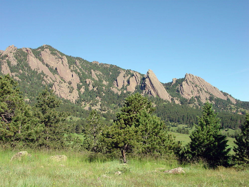
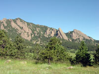
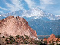
The Southern Rocky Mountains have a long history, starting with the uplift of the ancestral Rocky Mountains in Pennsylvanian time when much of North America was experience tectonic upheavals and mountain-building as the North American Plate collided with South America, Africa, and Eurasia to form the supercontinent Pangaea. During Pennsylvanian time, uplift an erosion scoured away the older sedimentary cover, exposing crystalline basement rocks. Sediments eroded from these ancient mountains are preserved along the flanks of the modern mountain ranges as the Fountain Formation, a conglomeratic "arkose" alluvial deposit of Pennsylvanian age (Figures 108 to 110). The ancestral Rocky Mountains gradually wore away. By Mesozoic time, the region was a low coastal plain (home to dinosaurs preserved in the Jurassic Morrison Formation). The region was likely submerged by marine waters of the Western Interior Seaway in Cretaceous time.
The Laramide Orogeny started impacting the Southern Rocky Mountain region in Late Cretaceous time, and the Western Interior Seaway retreated as the first phase of mountain building began to push up the modern Rocky Mountains. The modern Rockies roughly formed in the same regions of the Ancestral Rockies, probably reactivating many of the faults in the region. Near the end of the Laramide Orogeny the Southern Rocky Mountains experienced scattered volcanism including in parts of the Front Range and the San Juan Mountains regions. Uplift proceeded in stages through early Tertiary time, and then the entire region started to rise again starting in Miocene time, lifting the entire Rocky Mountains and western Great Plains nearly a mile.
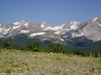
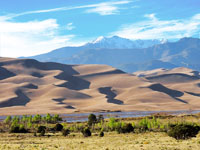
Nearly all of the high mountain areas where host to alpine glaciers during the Pleistocene ice ages. Alpine glaciers carved U-shaped valleys and tarn (glacial lakes with moraine dams). The Rocky Mountains still has a few small glaciers and ice fields in the high country in the Colorado Front Range, such as in Rocky Mountain National Park (Figure 111). Great Sand Dunes National Park is a massive dune field that has accumulated along the western flank of the Sangre de Christo Mountains in the San Luis Valley (Figure 112). |
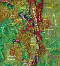
Fig. 107. Southern Rocky Mountains region of Colorado and New Mexico.
|
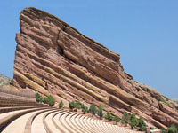 Fig. 108. Fountain Formation exposed at Red Rocks Amphitheater, Denver, Colorado. Fig. 108. Fountain Formation exposed at Red Rocks Amphitheater, Denver, Colorado. |
 |
 |
 |
 |
| Fig. 109. The Flatirons of Boulder, Colorado consist of red arkosic conglomerate of the Fountain Formation of Pennsylvanian age. |
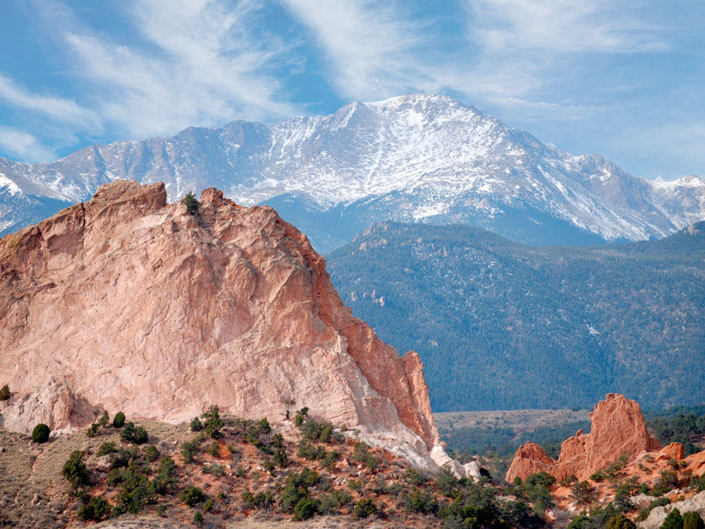
Fig. 110. Pennsylvanian Fountain Formation is exposed in the Garden of the Gods National Natural Landmark; Pikes Peak in the distance. |
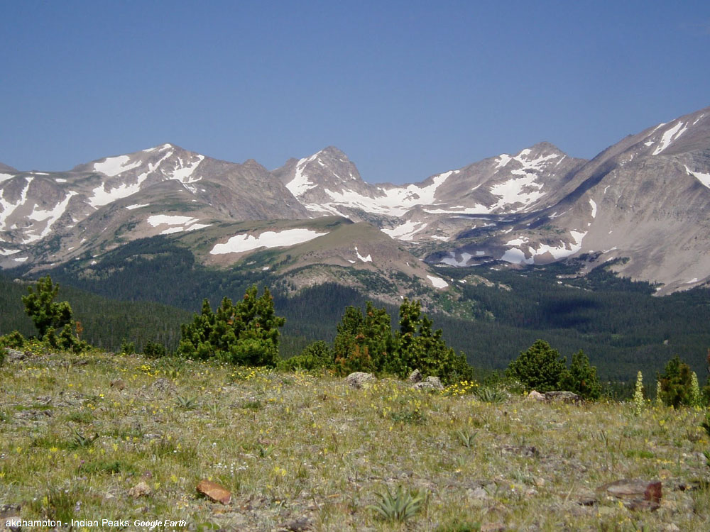
Fig. 111. Indian Peaks Wilderness preserves alpine country along the continental divide in the granitic core of the Colorado Front Range. |
Fig. 112. Great Sand Dunes National Park preserves a massive dune field on the west side of the Sangre de Christo Range in Southern Colorado. |
|
| https://gotbooks.miracosta.edu/geology/regions/southern_rocky_mountains.html 1/20/2017 |

|
 |
|
|

 Fig. 108. Fountain Formation exposed at Red Rocks Amphitheater, Denver, Colorado.