Regional Geology of North America |
|
Peninsular Ranges |
Click on images for a
larger view. |
|
The Peninsular Ranges are a group of Coast Range mountains that trend north-to-south and run from near Los Angeles southward into Mexico’s Baja Peninsula (Figure 283). Interstate 10 between Los Angeles and Palm Springs runs through San Gorgonio Pass, a valley that divides the Transverse Ranges to the north from the Peninsular Ranges to the south. San Jacinto Peak, 10,834 ft (3,302 m), is the highest peak in the San Jacinto Mountains and highest in the Peninsular Ranges. San Jacinto Peak overlooks Palm Springs and San Gorgonio Pass (Figure 284).
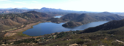
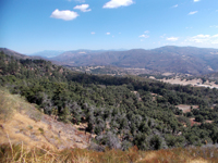
Rocks exposed in the Peninsular Ranges are mostly Mesozoic-age granites that have intruded older, partially metamorphosed sedimentary and volcanic rocks. The rocks that make up the Peninsular Ranges are part of the Salinian Block, a long linear section of crust that was originally attached to the North American Plate, but became detached and has gradually moved northward along the west side of the San Andreas Fault. The Peninsular Ranges have been rising as new ocean crust is forming along spreading centers underneath the Gulf of California and the Colorado Desert region (see Figure 225). The coast mountains are mostly chaparral with oak woodlands, with mixed conifers in higher elevations (Figures 285 and 286). San Diego County has 24 peaks over 5,000 feet; Hot Springs Mountain, elevation 6,533 feet is the highest. |
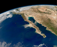
Fig. 283. Peninsular Ranges are the core of the Baja Peninsula between Los Angeles and Cabo San Lucas, Mexico. |

|
 |
 |
| Fig. 284. San Jacinto Peak, 10,834 ft, near Palm Springs, is the highest peak in the Peninsular Ranges. |
Fig. 285. Peninsula Ranges in northern San Diego County. Lake Hodges Reservoir fills the valley of the San Dieguito River, one of the principle streams draining the highlands of the northern Peninsular Ranges. |
Fig. 286. View from Mount Palomar, a high ridge in the Peninsular Ranges in northern San Diego County. |
|
Coastal Southern California
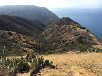
Southern California is notoriously famous for having numerous active Earthquake faults, both onshore and offshore (Figure 287). Southern California has submerged borderlands offshore. The Channel Islands (to the north) and San Clemente Island, Catalina Island, and San Nicolas Island are exposed tops of several submerged seamount ranges off the coast. Santa Catalina Island is a block of ocean crust of the ancient Farallon Plate that escaped subduction and accretion onto the continent (Figure 288).
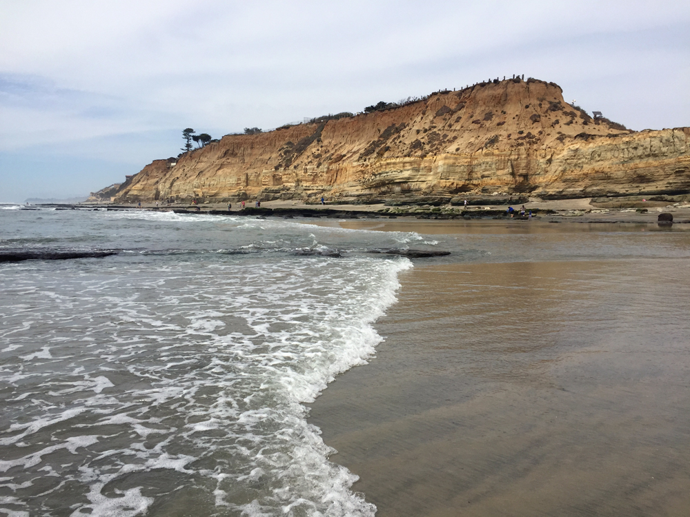
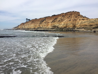
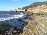
The coastline of San Diego County is highlighted by a series of step-like marine terraces carved by wave erosion as sea level has risen and fallen as the coast is slowly rising. Step-like terraces can be seen along the coast from Los Angeles to San Diego Bay (Figure 289). The west side of the Peninsular Ranges are slowly rising. Wave-cut cliffs along the coast exposed sedimentary rock formations that originally were deposited as sediments in coastal marine environments. Cabrillo National Monument is on Point Loma,a fault-bounded highland peninsula overlooking San Diego Bay (Figures 290 and 291). |
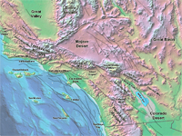 Fig. 287. Southern California, bathymetry, topography, and major faults. Fig. 287. Southern California, bathymetry, topography, and major faults. |
 |
 |
 |
|
| Fig. 288. 2000 foot sea cliffs on Santa Catalina Island, one of the Channel Islands located off the coast of southern California. |
Fig. 289. Tertiary rock formations exposed in sea cliffs under elevated marine terrace deposits at Del Mar Dog Beach. |
Fig. 290. Cretaceous rocks crop out along sea cliffs at Cabillo National Monument, San Diego, California. |
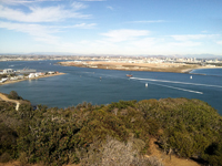
Fig. 291. View looking east from the highlands on Point Loma overlooking San Diego Bay and Coronado Island. |
|
| https://gotbooks.miracosta.edu/geology/regions/peninsular_ranges.html 9/3/2022 |

|
 |
|
|

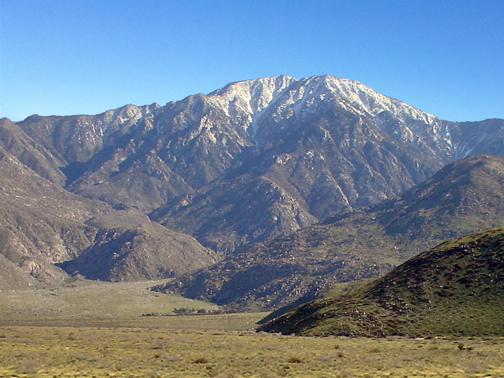
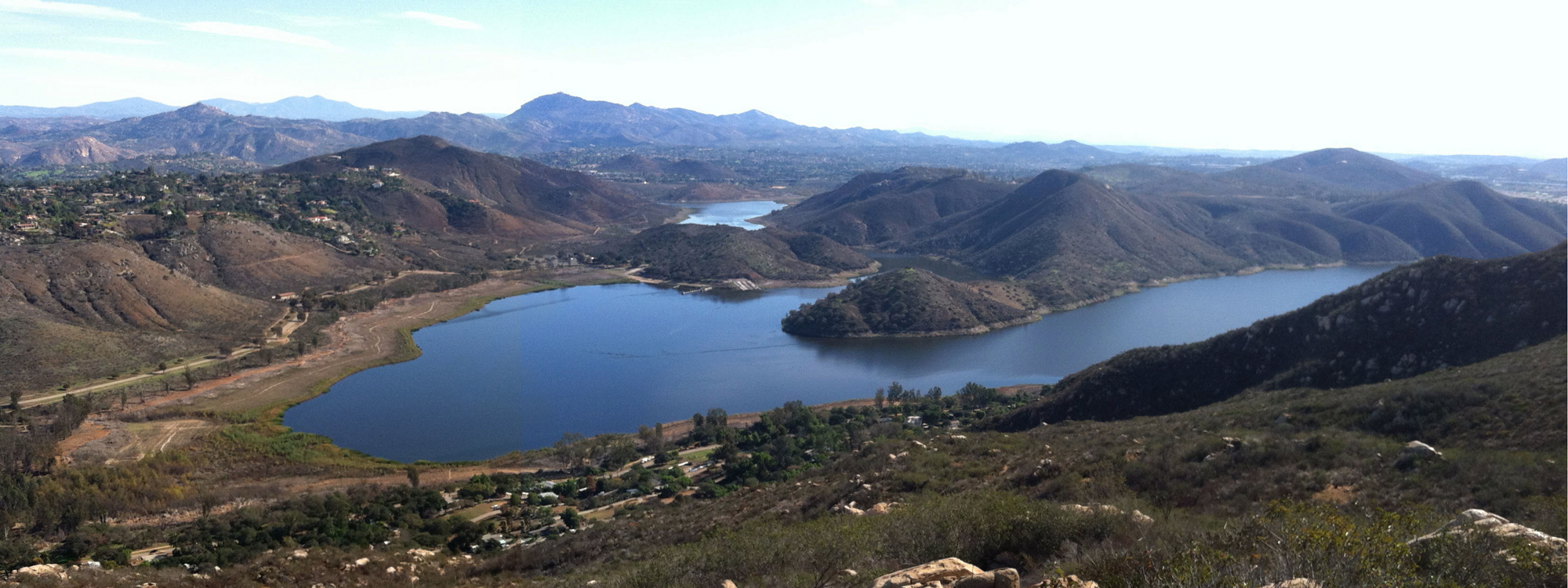

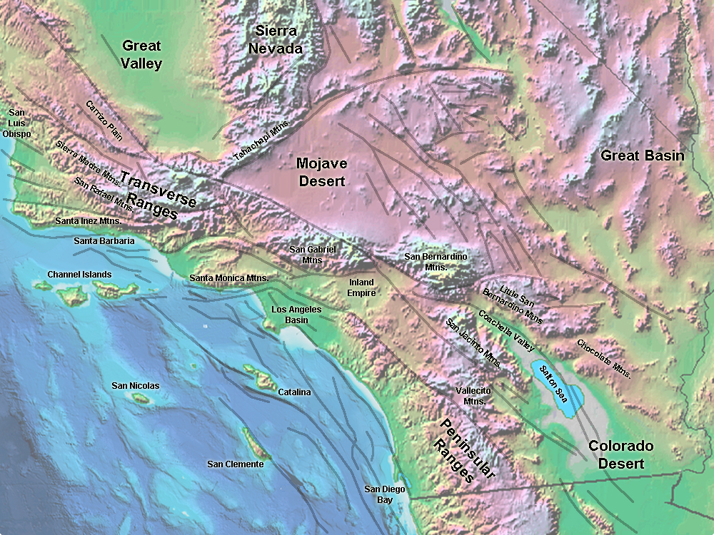 Fig. 287. Southern California, bathymetry, topography, and major faults.