
Introduction to Geology |
Canadian Shield |
Click on images for a |
| The Canadian Shield encompasses the most extensive region of North America and is host to most of the oldest rocks on the continent, consisting dominantly of ancient volcanic and plutonic igneous rocks
(Figure 10). The Canadian Shield dominates all of eastern Canada. Hudson Bay is located at the center of the Canadian Shield region. It is bounded on the north and east by the Arctic Archipelago region and by Greenland and the North Atlantic Ocean. On the south the Canadian Shield is bounded by the Great Lakes and the St. Lawrence River Valley region. The character of the Canadian Shield's landscape is highly influenced by the scouring erosion of moving ice of the Laurentide Ice Sheet that covered most of Canada during the Pleistocene ice ages (Figure 11). Continental glaciers stripped off the sedimentary cover that may have covered much of the region before the ice ages. As a result ancient igneous and metamorphic rocks are exposed at or near the surface and are host to the many important metals and strategic mineral deposits mined in eastern Canada. |
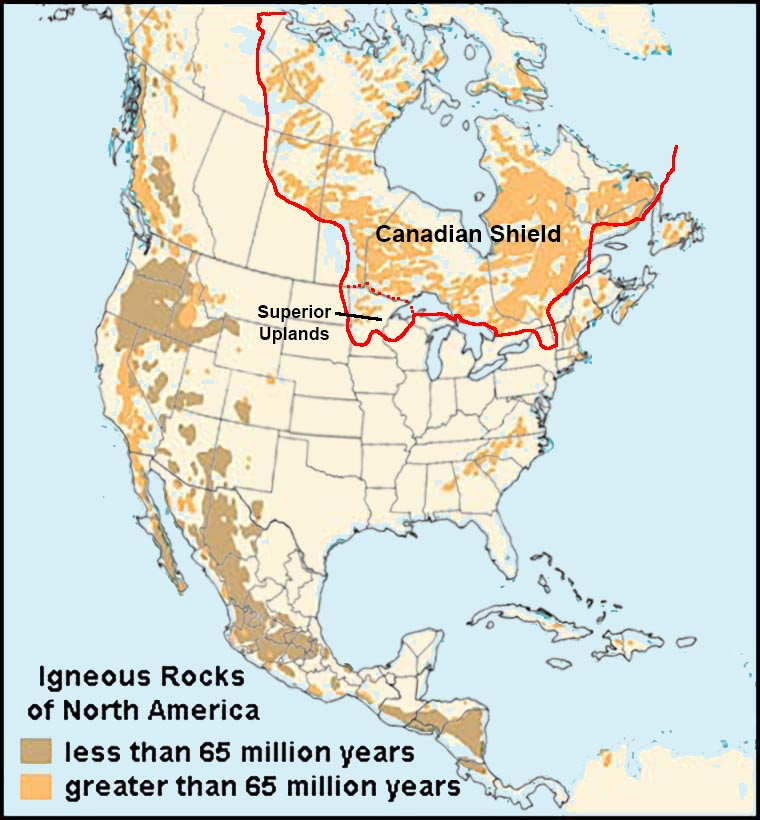 Fig. 10. Canadian Shield region of North America with ancient volcanic & plutonic igneous rocks. |
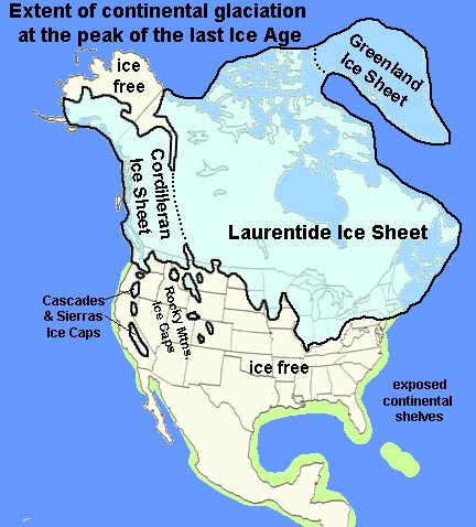 Fig. 11. The Laurentide Ice Sheet blanketed the entire Canadian Shield Region. |
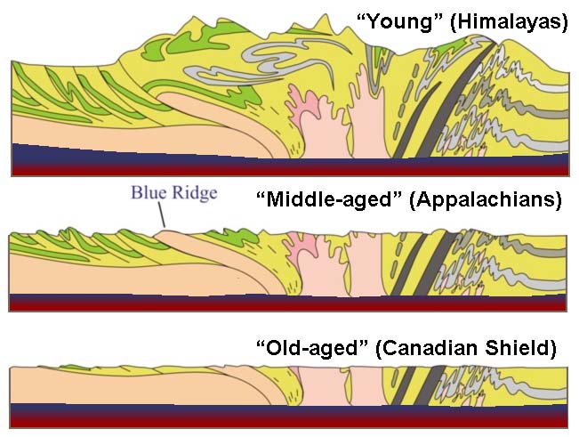 Fig. 12. The Canadian Shield is the ancient core of the North American continent. |
Although the bedrock in the Canadian Shield is extremely old—having formed roughly more than 2 to 3 billion years ago in mountain ranges and small landmasses crushed together by plate-tectonic forces. However, those ancient mountain ranges eroded away long ago, and the crust in the region has grown thinner, and sits isostatically lower that other younger, thicker crust in the surrounding province regions (Figure 12). However, because of the geologically recent glaciations, the Canadian Shield displaces a relatively chaotic surface appearance, having numerous lakes and "deranged" river drainage patterns on the recently glaciated landscape.Superior Uplands ProvinceThe Superior Uplands Province is part of the Canadian Shield that extends into the United States around the western end of Lake Superior (Figure 12), encompassing part of Minnesota, upper Michigan and Wisconsin. Ancient igneous and metamorphic rocks are exposed in what are called the Iron Ranges where belts of Precambrian-age banded-iron formation deposits are exposed and have been extensively mined to provide iron ore shipped to steel mills throughout the easter Great Lakes region. The timbered and rocky shorelines in the Superior Lowlands Province are host to the Apostle Islands National Lakeshore and Voyageurs National Park. |
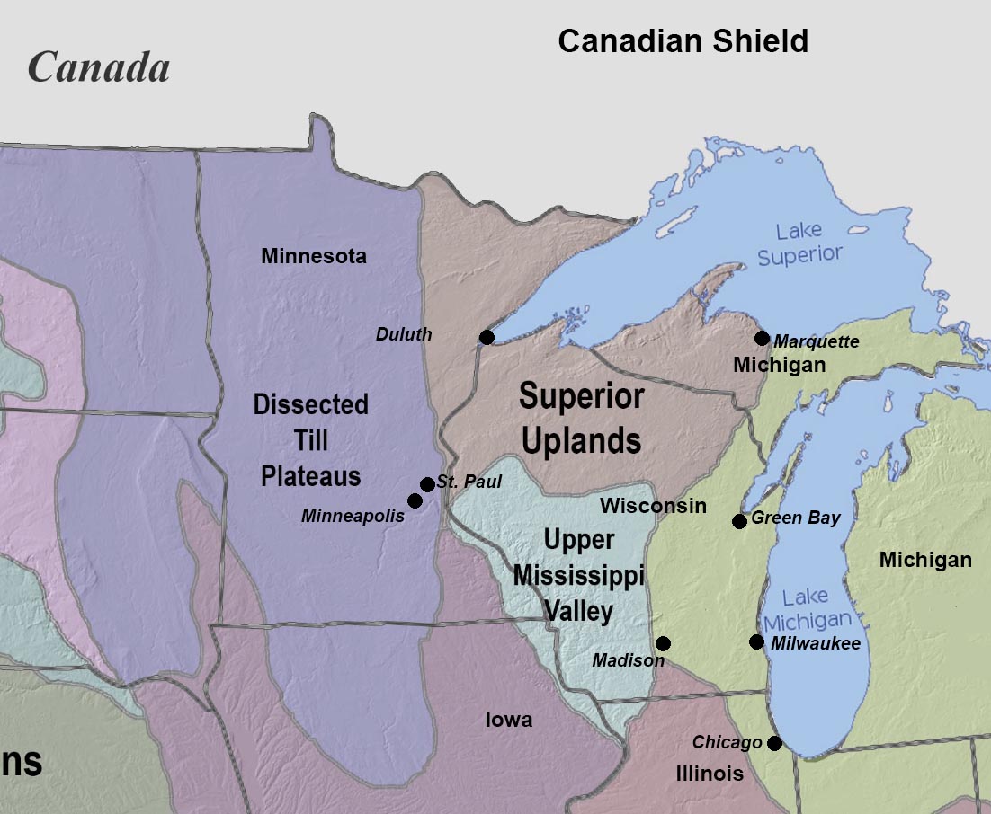 Fig. 13 Map showing the Superior Uplands Province with Upper Mississippi River Valley region (part of the Central Lowlands Province). |
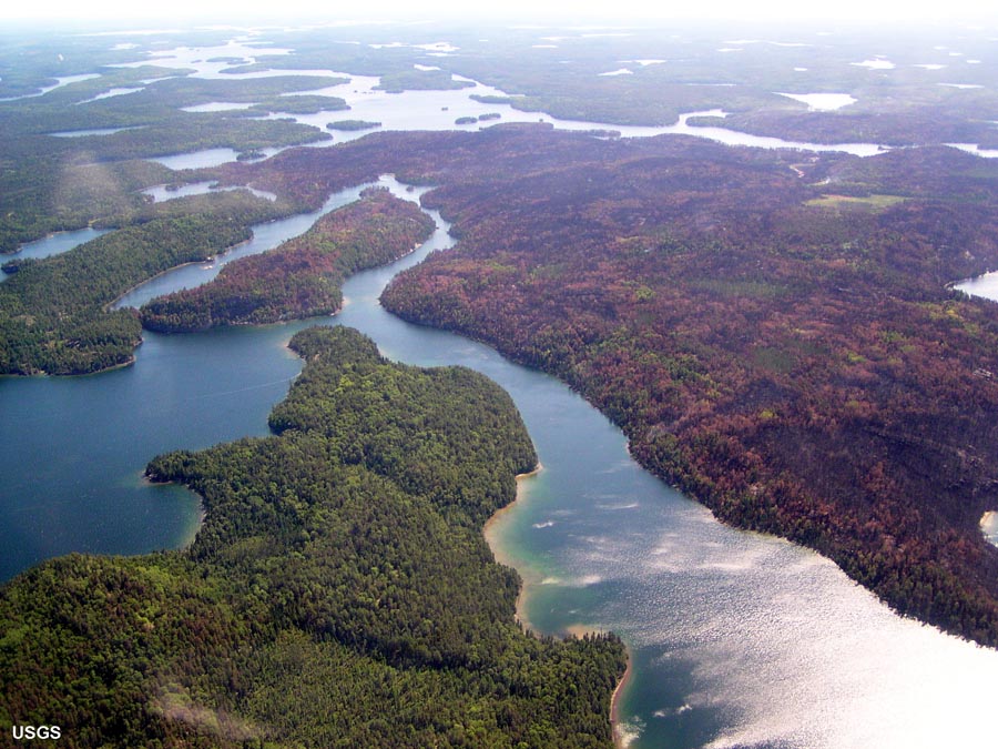 Fig. 13a. This aerial view of Voyageurs National Park shows typical landscape character of the Superior Lowlands Province. |
| https://gotbooks.miracosta.edu/geology/regions/canadian_shield.html 9/4/2022 |