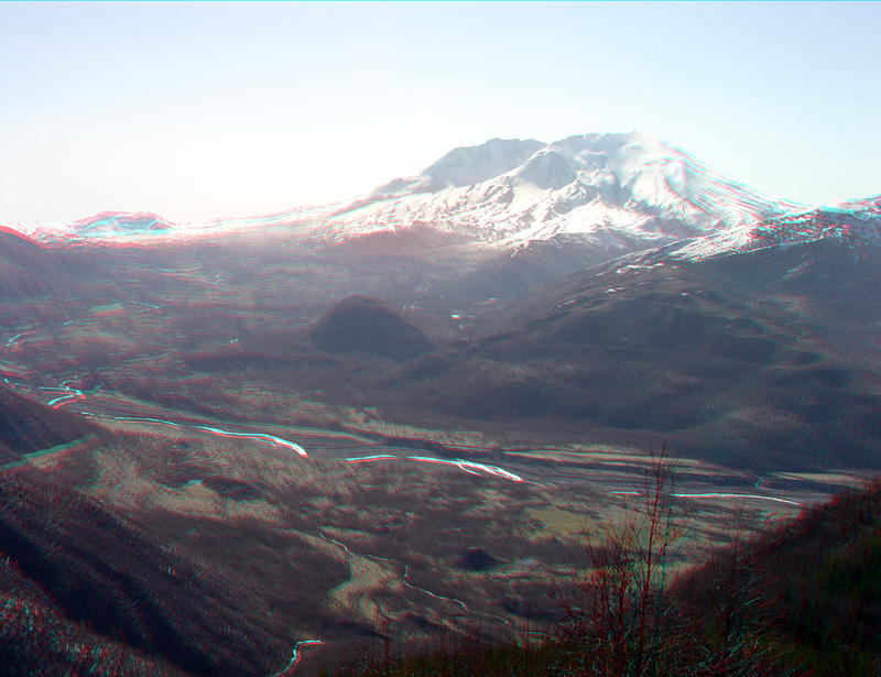
| This view from near the Forest Learning Center along WA Highway
504 shows the north flank of Mount St. Helens where much of the debris from
the massive 1980 avalanche/eruption spilled into the valley of the Toutle
River valley. The eruption produced about 3 cubic kilometers of ash and sediment distributed across the landscape around the volcano. This material is being transported downstream, causing major economic damage to the communities and infrastructure (Costa, 1994). In the years since the eruption the major streams in the
valley have re-established themselves. Shrublands, forests, and aquatic
ecosystems are gradually re-establishing themselves, yet large, barren expanses
along the streams and in the badlands-style debris fields on and around
the volcano are still a source of dust (ash) on particularly dry, windy
days. |