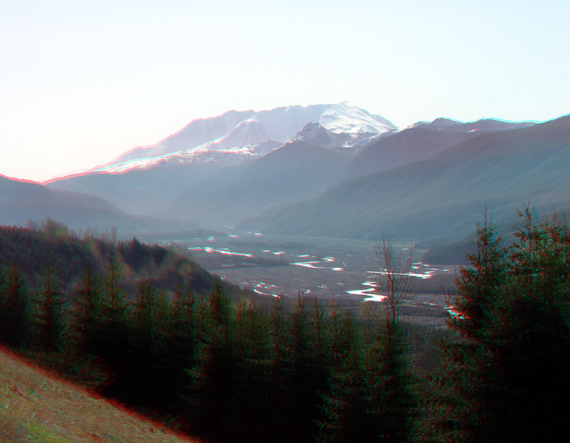
| This view taken along WA Highway 504 shows the sediment-clogged
valley of the North Fork of the Toutle River. Morning light reflects off
natural ponds and and stream channels of the broad valley filled with debris
primarily derived from the 1980 eruption of Mount St. Helens (visible in
the distance). This view is facing east from a roadside pull-off near the
Hoffstadt Bluffs Visitor Center. On May 18th, the largest terrestrial landslide in modern recorded history triggered a volcanic blast that devastated a large region around the volcano. Since that time, Mount. St. Helens has additional volcanic and seismic activity as the volcano slowly rebuilds itself. (Driedger and others, 2010; Ramsey and others, 2008). |