
Sequoia National Park, California
This website is a collection of photos of parts of Sequoia National Park. The Giant Sequoia groves are the target of most travellers interest who come to Sequoia National Park, and rightly so. They are beyond impressive. However, the geologic story of the park is also amazing.
Unfortuately, this website does not include pictures in the high back-country lakes region, the Crystal Cave area, or the Mineral King regions of the park. These areas were closed at the time of this visit, partly because of weathern and partly to closures to restore road and infrastructure damage from the massive fires that burned through large portions of the park in 2019.
Hopefully, we will be able to add these areas in the near future, along with imagery from Kings Canyon National Park.
For more information visit the Sequoia/Kings Canyon National Parks website: https://www.nps.gov/seki.
Learn more about the park plants, animals, and ecology.
|
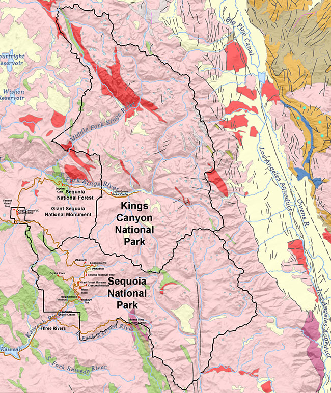
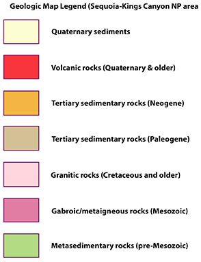
Generalized geeologic map of the Sequoia and Kings Canyon National Parks in the Sierra Nevada Range of California.
(Click on map and images for a larger view.)
Learn more about the park geology (NPS.gov)
|
Selected Views of Sequoia National Park
The image gallery below partly illustrate the experience of visiting Sequoia National Park (be sure to click on images for a larger view).
The park is perhaps most famous for it's namesake: the Giant Sequoia trees. But it also is host to a variety of ecozones ranging from raparian forests along the lower stream valleys, grassy meadows and mixed oak forests, spruce and pine forests in the upland moutainous region, and barren tundra habitats in the high mountain peaks region above timberline. Most visitors only go to locations that are easily accessible along the park roads, but much of the park is back-country wilderness, accessible by trails, some leading up to the high peaks of the crest of Sierra Nevada Range along the park's eastern boundary.
Figure 1 View along a trail amongst the giant sequoias in the Giant Forest area.
Figure 2 View of Ash Peak on south side of Kaweah River canyon from Potwisha Campground.
Figure 3 View of the high peaks along the southern Sierra Nevada Range as viewed from the top of Moro Rock.
Figure 4 NPS display along Moro Rock Trail showing the names of the high peaks of the high crest of the Sierra Nevada range. |
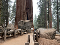
Fig. 1. Trail in sequoia forest |
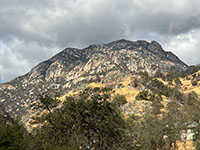
Fig. 1. Ash Peak near VC. |
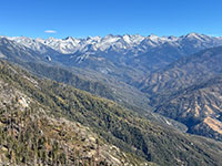
Fig. 3. Sierra Crest. |
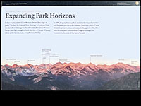
Fig. 4. High peaks named. |
|
Giant Forest Trails, General Sherman Tree, Congress Loop Trail
The images below illustrate the scenery along the trails in the Giant Forest area (including the General Sherman Tree and the Congress Loop Trail). It is somewhat difficult to get a whole Giant Sequoia in a photograph. Figures 5 to 30 views along trails throughout the Giant Forest area. In many locations large trees are clusted close together as "groves" and have been assigned names, such as "The House" and "The Senate" along the Congress Loop Trail. |
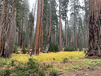
Fig. 5. Giant sequoia forest |

Fig. 6. Giant sequoia grove |
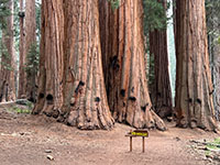
Fig. 7. The House grove |
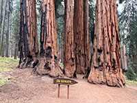
Fig. 8. The Senate Grove |
|
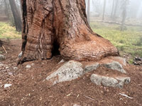
Fig. 9. Root foot on rock |
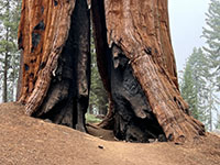
Fig. 10. Fire damaged trees |
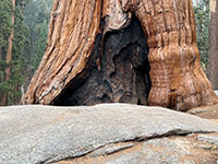
Fig. 11. Fire damaged tree |
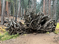
Fig. 12. Fallen sequoia roots |
|
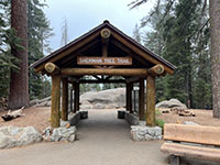
Fig. 13. General Sherman Trail |
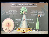
Fig. 14. General Sherman Tree |
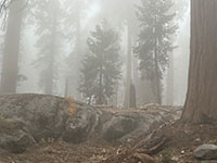
Fig. 15. Young trees in fog. |
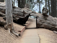
Fig. 16. Trail cut through tree |
|
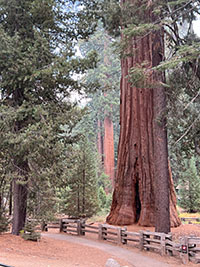
Fig. 17. General Sherman trail |
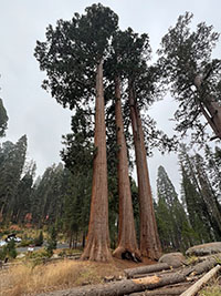
Fig. 18. Giant Sequoias |
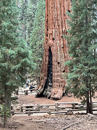
Fig. 19. General Sherman tree |
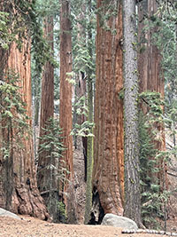
Fig. 20. Giant Sequoias |
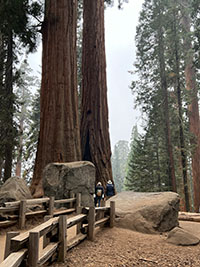
Fig. 21. Congress Loop Trail |
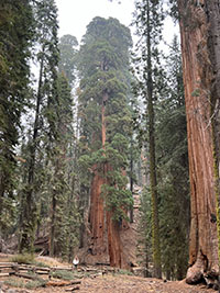
Fig. 22. Giant Sequoia |
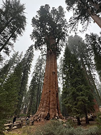
Fig. 23. General Sherman tree |
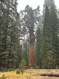
Fig. 24. General Sherman tree |
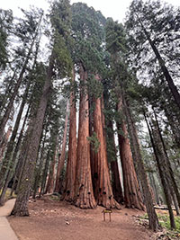
Fig. 25. The House Grove |
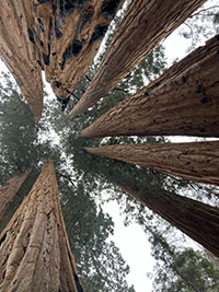
Fig. 26. Looking up |
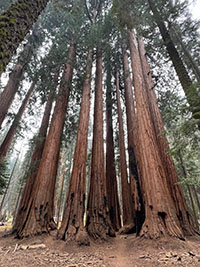
Fig. 27. The House Grove |
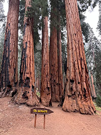
Fig. 28. The Senate Grove |
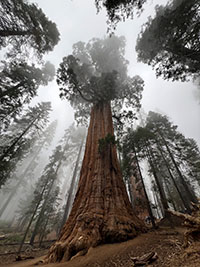
Fig. 29. Giant Sequoia in fog. |
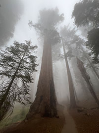
Fig. 30. Giant Sequoia in fog. |
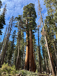
Fig. 31. Crescent Meadow. |
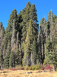
Fig. 32. Crescent Meadow. |
|
Crescent Meadow and Moro Rock Area
Crescent Meadow is a scenic open grassy meadow within the Giant Forest area (Figures 31-32 [above] and 33-36 [below]). Crescent Meadow was among the favorite spots that John Muir like to visit as he worked to help establish Sequoia National Park in 1890.
Moro Rock is a scenic hiking destination in the Giant Grove area (access may be difficult during the crowded summer season and closed in the winter).
Figure 37 is a view looking up at Moro Rock from below along the Park Road. Figure 38 is a view of Moro Rock from nearby Hanging Rock (Figures 39-40). Both rocks are remnants of Cretaceous age plutons of the greater Sierra Nevada Batholith.
Figure 41 is a view looking up a burned-out sequoia along the path to Hanging Rock (located near Moro Rock).
Figures 42-44 are views of the stairs trail leading up to the overlook on top of Moro Rock. Note there are 350 steps along the narrow path to the top, but the views are worth it.
Figure 45 is a view of the Sierra Crest region from the top of Moro Rock.
Figure 46 is looking across the Middle Fork Kaweah River valley to Castle Rocks (another remnant of Cretaceous age plutons of the Sierra Nevada Batholith).
Figures 47 and 48 are views looking west down the Kaweah River canyon where it eventually drains into California's Central Valley.
|
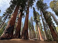
Fig. 33. Sequoia grove |
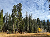
Fig. 34. Crescent Meadow |
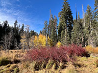
Fig. 35. Meadow fall folliage |
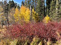
Fig. 36. Meadow fall folliage |
|
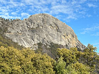
Fig. 37. Moro Rock |
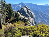
Fig. 38 Moro Rock |
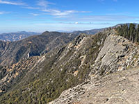
Fig. 39. Hanging Rock |
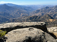
Fig. 40. Hanging Rock View |
|

Fig. 41. Hollow sequoia trunk |
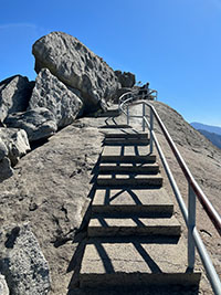
Fig. 42. Moro Rock stairs up |
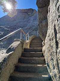
Fig. 43. Moro Rock stairs up |
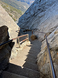
Fig. 44. Moro Rock stairs |
|

Fig. 45. Sierra Crest view |
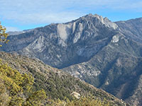
Fig. 46. Castle Rocks |
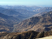
Fig. 47. Moro Rock view |
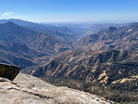
Fig. 48. Hanging Rock view |
|
Destinations in the Lower Valley (canyons) of the Kaweah River
Figure 49 to 52 show views in the vicinity of Swinging Bridge on Kaweah River near Potwisha Campground.
Figure 51 shows indian mortar holes on a large outcrop along the river near the bridge. If you look up in the vicinity of the mortar holes you might see this indian pictograph preserved on a granite outcrop (Figure 52).
Figures 53 to 56 shows waterfalls and pools along lower Marble Fork of Kaweah River near Potwisha Campground.
Figure 57 shows a ridge of metamorphic rock cropping out on hillside along Marble Fork near Potwisha Campground.
Hospital Rock is located near the entrance to Buckeye Flats campground road, now a hiking trail (Figures 58 to 60). (The "Hospital" is a large overhang beneath what was possibly a great glacial erattic. In the vicinity are an abundance of mortar holes in granite (Figure 59), and a pictograph panel on the side of a massive boulder adjacent to Hospital Rock (Figure 60). |
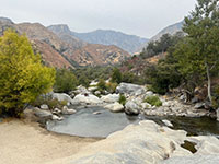
Fig. 49. Kaweah River. |
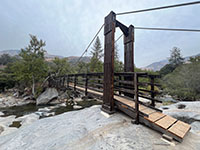
Fig. 50. Swinging Bridge |
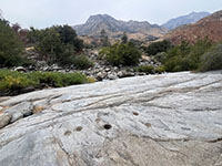
Fig. 51. Indian mortar holes |
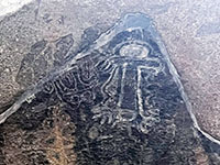
Fig. 52. Indian pictograph |
|

Fig. 53. Marble Fork |
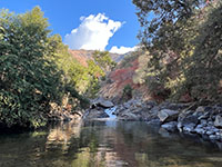
Fig. 54. Pool on Marble Fork |
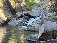
Fig. 55. Falls on Marble Fork |
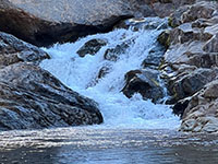
Fig. 56. Falls on Marble Fork |
|
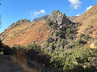
Fig. 57. Metamorphic ridge |
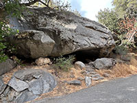
Fig. 58. Hospital Rock |
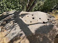
Fig. 59. Mortars at Hospital R. |
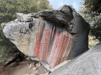
Fig. 60. Pictographs at H.R. |
|
Rocks of the Sierra Nevada Batholith Granodiorite, gabbro, and xenoliths (of gabbro) imbedded in granitic plutonic rocks are common throughout the park (Figures 61 to 64). A xenolith (meaning"foreign rock") is a rock fragment derived from older surrounding country rock) that becomes enveloped in a larger igneous rock body during the latter's development and solidification. These all formed as part of the plutonic intrusion phase that formed throughout the the Sierra Nevada volcanic arc (and associatiated underlying batholith) during Late Cretaceous time.
Rocks along the Buckeye Flats/Paradise Creek Trails
Older metamorphic rocks that predate the Sierra Nevada batholith crop out in many places throughout the park region. Perhaps the easiest and best places to see them area along the Buckey Flats/Paradise Creek Trails. Paradise Creek is a fork of the Kaweah River (Figure 65). Along the "closed road" (now hiking trail) to Buckeye Flats Campground are outcrops of metamorphic rocks (schist and gneiss). Thee rocks probably represent ancient marine sediments deposited in offshore basins in late Paleozoic to early Mesozoic time, but were metamorphosed in the early stages of moutain building that led to the formation of the Cordilleran Ranges along western North America. This occurred prior to the formation of the Sierra Nevada volcanic arc and batholith. Large blocks of "pre-batholith" metamorphic rocks imbedded in the granite are call "roof pendants." Note that the uplift and erosional formation of the modern Sierra Range occurred much later beginning in Miocene time.
Figures 66 and 67 show layered metamorphic rocks (schist and gniess) exposed along the closed road to the Buckeye Flats Campground.
Figure 68 shows a large augen (eye-shaped crystal pattern) preserved in the layered beds of schist and gneiss.
Figure 69 shows a bridge over Paradise Creek along the Paradise Creek Trail. The Paradise Creek Trail starts at the Buckeye Flats Campground.
Figures 70 to 74 show views of the gneiss/schist outcrops along the stream near the bridge. Figures 73 and 74 show small granitic bodies that intruded or formed within the older gneiss/schist.
Figures 75 and 76 show the canyon, cataracks and falls near the Buckeye Flats Campground. |
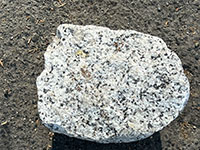
Fig. 61. Granodiorite |

Fig. 62. Gabbro |
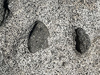
Fig. 63. Xenoliths |
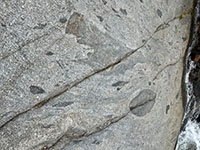
Fig. 64. Xenoliths |
|
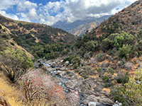
Fig. 65. Paradise Creek |
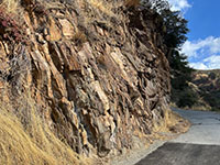
Fig. 66. Schist & sneisss |
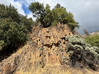
Fig. 67. Schist |
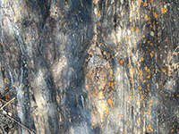
Fig. 68. Augen in schist |
|
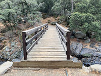
Fig. 69. Paradise Creek bridge |
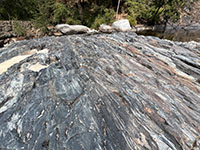
Fig. 70. Schist & gneiss |
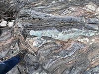
Fig. 71. Schist & gneiss |
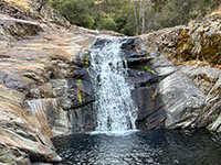
Fig. 72. Waterfall near trail |
|

Fig. 73. Granite in schist |
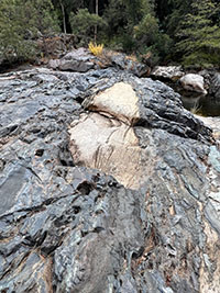
Fig. 74. Granite in schist |
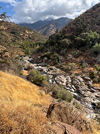
Fig. 75. Paradise Creek |
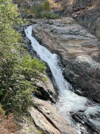
Fig. 76. Falls near campground |
|
Other Park Features
This website is incomplete. It really should include the geologic features, including the landscape features associated with Pleistocene glaciation periods. It should also include a section about the Crystal Cave and Mineral King areas (they were unaccessible at the time this website's photography was compiled.
Part of the story is the devestation caused by the wildfires that have burned throughout the park. Figure 77 shows a view of the park entrance sign at the north end of the park road. Recent fire-burn areas are scatter throughout the park, but fortunately large areas have not burned. Figure 78 shows one of the views of the forested upland landscape from along the park road between Dorst Creek and Wuksachi Village.
Figure 79 shows Tunnel Rock near the south park entrance. This view show the historic park road that used to pass under the rock. Figure 80 illustrates why that short section of the road was abandoned. |
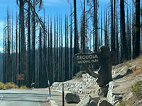
Fig. 77. Burn near park sign |
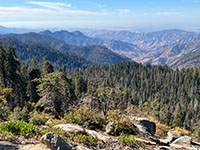
Fig. 78. Park road view. |
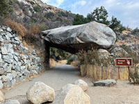
Fig. 79. Tunnel Rock |
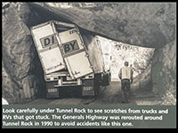
Fig. 80. Tunnel Rock display |
|
This page is <https://gotbooks.miracosta.edu/gonp/seki/>
Last modified 12/5/2024.
|
|


