| Airliner view of the Outer NY Harbor at the mouth of the New York Bight. |
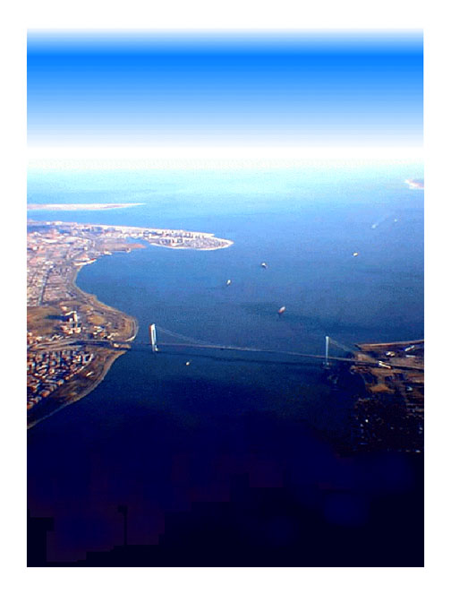 |
| The main home-page graphic (below) was taken from a San Francisco
to Kennedy Airport flight in 1998. The view looking east is of the
Verrazano Bridge (across the Verrazano Narrows) that separates the
inner and outer New York Harbor. On the left (closer to farther, respectively)
is the terminal moraine that forms Bay Ridge (by the bridge), the
"outwash plain" in the vicinity of Belt Parkway through
Bensonhurst, Brooklyn, and the modern barrier islands of Coney Island
and Breezy Point (of the Rockaways). On the right is Fort Wadsworth
and the eastern end of South Beach (both part of Gateway National
Recreation Area on Staten Island). The northern tip of Sandy Hook
in the distant right defines the harbor entrance to Raritan Bay and
the Atlantic Ocean in the distance. Ships are following the main shipping
channel into New York Harbor. |
|