 |
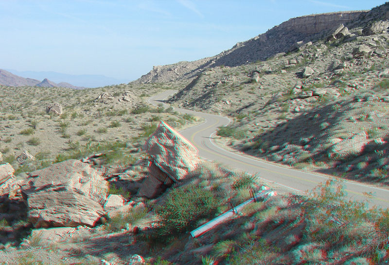
This view is looking east along the Pierce Ferry Road (Arizona Highway 25) about 7 miles north of Meadview. The road was constructed through a slope covered with great blocks derived from caprock of Hualapai Limestone exposed along the mesa top on the right of this image. The limestone formed in a shallow lake basin that existed here (between about 6.0 and 4.4 million years ago in Late Pliocene time). The lake existed before the formation of the modern Colorado River and the modern Grand Canyon (Faulds and others, 2008; Beard and others, 2007). These layers of limestone form the caprock of part of Grapevine Mesa (to the right). |


