 |
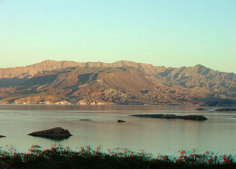
This late afternoon view of the Boulder Basin area of Lake Mead is from Sunset Point near milepost 7 on Lakeshore Scenic Drive. This view shows Fortification Hill, a mesa capped with gently dipping basalt lava flows of Late Miocene age. Large, dark talus cones of basalt-rock debris extend down the slopes into badlands consisting of older Middle Miocene-age sedimentary and volcanic basin-fill deposits. Wilson Ridge in the distance consists of Middle Miocene-age plutonic rocks and ancient Precambrian- (Proterozoic-) age crystalline basement rocks (gneiss, schist, and granitic rocks) (Honn and Smith, 2008,; Beard and others, 2007). Mt. Wilson, the high peak on the ridge, is 5,445 feet (1660 meters). The ridge is part of the Mount Wilson Wilderness managed by the Bureau of Land Management. |


