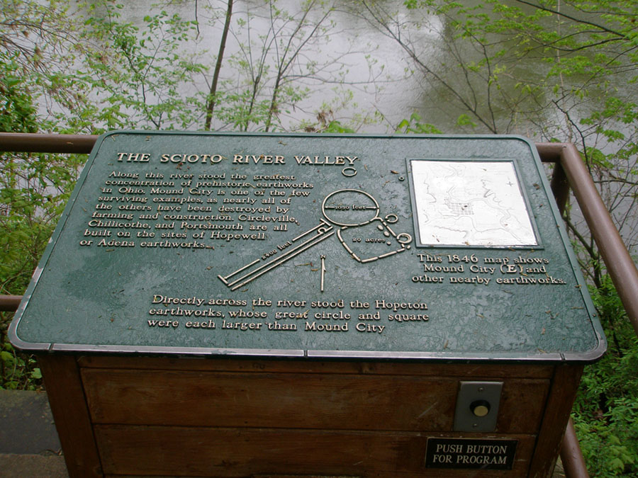
"THE SCIOTO RIVER VALLEY"
"Along the river stood the greatest concentration of prehistoric earthworks in Ohio. Mound City is one of the few surviving examples, as nearly all of the others have been destroyed by farming and construction. Circleville, Chillicothe, and Portsmith are all built on the sites of Hopewell or Adena earthworks."
"Directly across the river stood the Hopeton Earthworks, whose great circle and square were each larger than Mound City."
"This 1846 map show Mound City (E) and other nearby earthworks."
The Hopeton Earthworks complex includes a 20-acre circle, and 20-acre square, and several other small circles and parallel walls. The 292-acre portion of the Hopewell Culture National Historic Park is on the east terrace of the Scioto River (opposite of the Mound City site on the west side of the river). Access to the Hopeton Earthworks is from a parking area on the east side of the river. The site has a nature/scenic trail that connects a parking area to an overlook of the earthworks and ceremonial grounds.