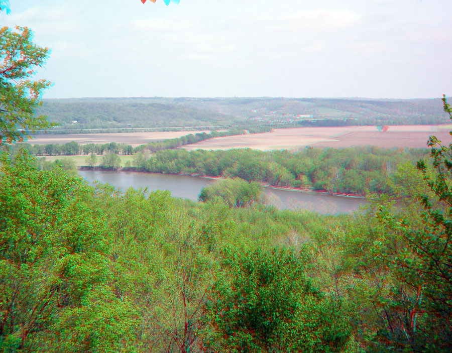
View from Shawnee Lookout Park looking west at the broad flood plain of the Great Miami River. This broad floodplain stands out in contrast to the narrow gorge and narrow floodplain along the larger Ohio River on the south side of Shawnee Lookout.
In this region, deposits of the terminal moraine of the Wisconsinian continental glacier can be found as far south as in the hilltop regions of northern Kentucky on the south side of the Ohio River. The narrow gorge of the Ohio River between Cincinnati (to the east) and Shawnee Lookout is less than about 14,000 years. The narrow Ohio River gorge probably formed partly from the catastrophic breakout of a large lake that had formed when the continental glacier blocked the original path of the upper Ohio River and Licking River drainages. An ancient path of those rivers originally flowed north along the Mill Creek Valley (northwest of downtown Cincinnati) and then flowed south down the Great Miami River Valley. This would partly explain why the Great Miami River valley had a much larger, broader floodplain than the Ohio River east of Shawnee Lookout Park. Earler in time (before massive glaciation cycles began), the ancestral Teays River system may have drained north into Canada, possibly to the Hudson Bay region. However, all trace of that ancient river system was erased by the continental glaciers building up and flowing south into the midcontient region.