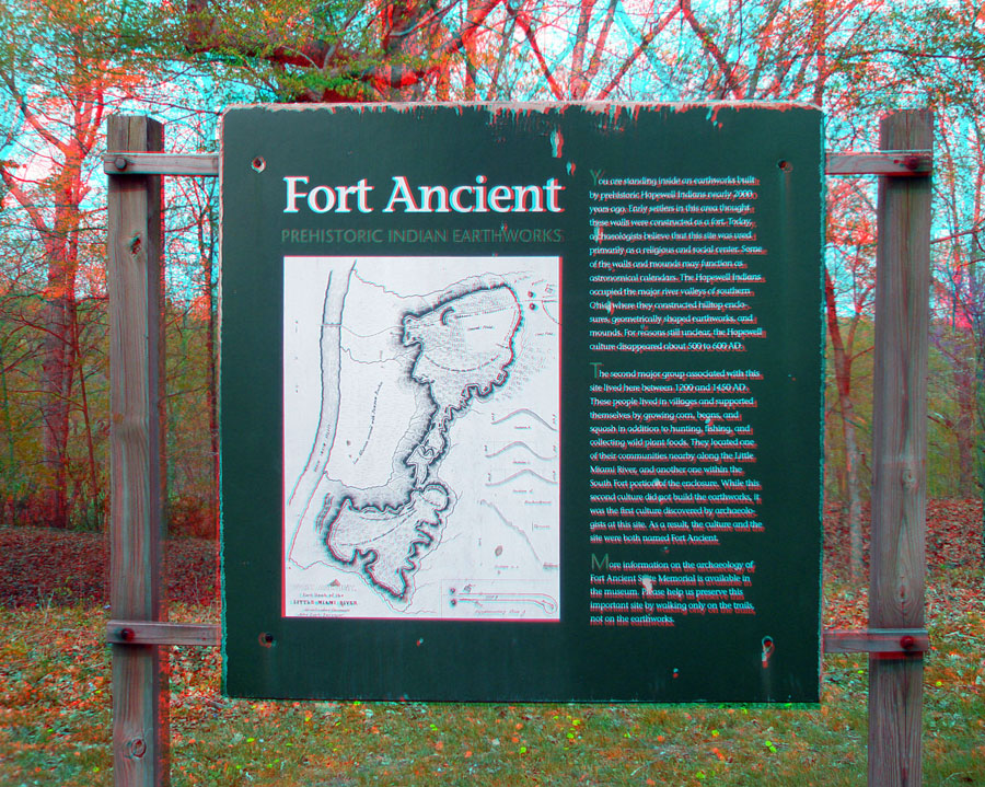
This sign reads:
"Fort Ancient"
"PREHISTORIC INDIAN EARTHWORKS""You are standing inside an earthworks built by prehistoric Hopewell Indians nearly 2000 years ago. Early settlers in this area thought these walls were constructed as a fort. Today, archaeologists believe that this site was used primarily as a religious and social center. Some of the walls and mounds ma function as astronomical calendars. The Hopewell Indians occupied the major river valleys of southern Ohio where they constructed hilltop enclosures, geometrically shaped earthworks, and mounds. For reasons still unclear, the Hopewell culture disappears about 500 to 600 A.D. The second major group associated with this site lived here between 1200 and 1450 A.D. These people lived in villages and supported themselves by growing corn, beans, and squash, in addition to hunting, fishing and collecting wild plant foods. They located on of their communities nearby along the Little Miami River, and another one within the South Fort portion of the enclosure. While this second culture did not build the earthworks, it was the first culture discovered by archaeologists at this site. As a result the culture and the site were both named Fort Ancient.
Note that the historical time line and interpretation of the site undergoes revision as information from this location and other regional archaeological sites become available.