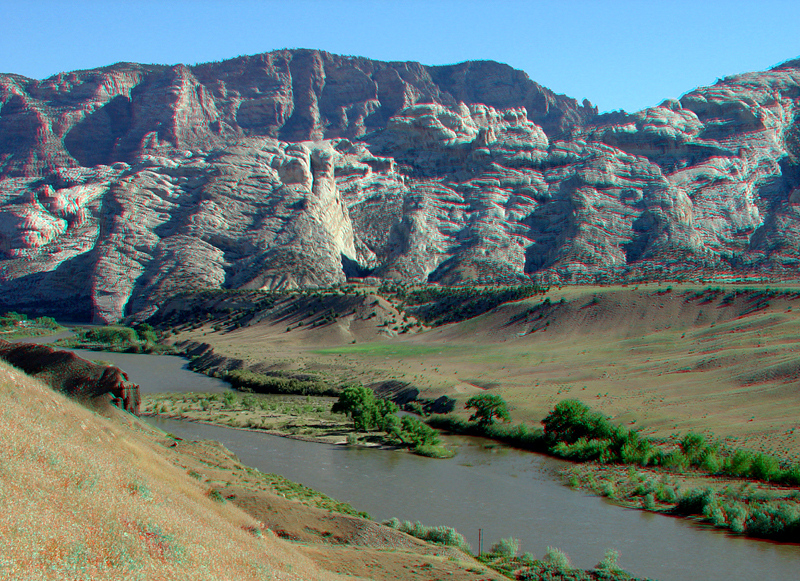
Beginning in the Late Cretaceous, about 70 million years ago, a great period of mountain building began, and slowly over time the sedimentary rocks in the basin were folded and broken by faults. Over perhaps millions of years the great folded anticlines and synclines of the early Rocky Mountains formed (during the Laramide Orogeny that lasted from Late Cretaceous to the Oligocene; Willis, 2000). Throughout middle Tertiary time, the Laramide mountain ranges wore down, and by Miocene time, the region was probably a region of low relief. In Late Miocene time the entire Colorado Plateau region began to rise - to its current elevation of about a mile above sea level. As the land rose, rivers and streams cut downward carving the great canyons cutting through mountain structures that had previously formed earlier during the Laramide Orogeny. Periods of glaciation took place within the last 2 million years. (See Foos and Hannibal, 1989; Gregson and Chure, 2000.) Climate variations occurred in association with these glacial periods and the intervening warm periods. Large-scale variations in climate had a significant impact on the amount of water flowing in the rivers and the amount of sediment moving down the river channels. As a result there were periods when the rivers and streams expanded their flood plains and sediments accumulated, and then during other periods the rivers and streams eroded down into their flood plains. These down cutting episodes left behind elevated stream terraces, two of which are clearly visible in this image: one is about 40 feet above the current river level and probably represents down cutting since the peak of the last major glaciation about 18,000 years ago, and the higher, well developed surface probably corresponds to an earlier major glaciation period in the Rocky Mountain region, possibly between 95,000 to 130,000 years ago (Chadwick and others, 1997). Elevated terraces like these can be seen along river and stream valley throughout the western states.