| |
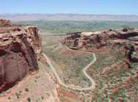 |
Click here to take an image tour of Colorado National Monument (3D or standard photography). To learn more about Colorado National Monument check out the National Park Service website at: http://www.nps.gov/colm/. |
|
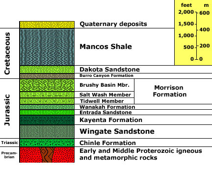
Scott, R. B., Harding, A. E., Hood, W. C., Cole, R. D., Livaccari, R. F., Johnson, J. B., Shroba, R. R., and Dickerson, R. P., 2001, Geologic Map of Colorado National Monument and Adjacent Areas, Mesa County, Colorado: U.S. Geological Survey Geologic Investigations Series I-2740, 40 p.; map, scale 1:24,000: http://pubs.usgs.gov/imap/i-2740/ Stratigraphic unit information is modified from the USGS GeoLex (Lexicon of Geology): http://ngmdb.usgs.gov/Geolex/geolex_qs.html. Information about the Geologic Time Scale is available at: https://gotbooks.miracosta.edu/gonp/coloradoplateau/timescale.htm. |