|
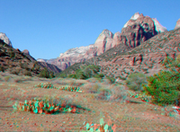 |
Click here to see a geologic image tour of Cedar Breaks National Monument. Website images consist of both standard photograph and 3D views (as anaglyphs - requiring red-and-cyan 3D viewing glasses). This view is looking west up the valley of the Virgin River toward the high cliffs of Navajo Sandstone and other rock units that form the canyon walls in Cedar Breaks National Monument. |
|
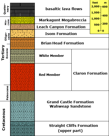
To learn more about Cedar Breaks National Monument check out the National Park Service website at: http://www.nps.gov/cebr/. Generalized geology after: Hatfield, S.C.and others, 2003, Geology of Cedar Breaks National Monument: In Geology
of Utah's Parks and Monuments, Sprinkel, D.A., Chidsey, T. C., and
Anderson, P. B., editors, Utah Geological Association Publication 28.,p. 107-138. Stratigraphic unit information is modified from the USGS GeoLex (Lexicon of Geology): http://ngmdb.usgs.gov/Geolex/geolex_qs.html. Information about the Geologic Time Scale is available at: https://gotbooks.miracosta.edu/gonp/coloradoplateau/timescale.htm. |