| |
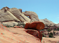 |
Click here to see a geologic image tour of Capitol Reef National Park. Website images include both standard photograph and 3D views (as anaglyphs - requiring red-and-cyan 3D viewing glasses). This view shows Pee-A-Boo Arch in the Navajo Sandstone. Orange cross-bedded sandstone of the Kayenta Formation crops out in the foreground along Upper Muley Twist Creek. To learn more about Capitol Reef National Park check out the National Park Service website at: http://www.nps.gov/care/. |
|
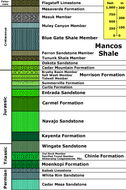
Stratigraphy after Morris, T. W., Manning, V. W., and Ritter, S. M., 2000, Geology of Capitol Reef National Park: In Geology of Utah's Parks and Monuments, Sprinkel, D.A., Chidsey, T. C., and Anderson, P. B., editors, Utah Geological Association Publication 28., p. 85-105. Stratigraphic unit information is modified from the USGS GeoLex (Lexicon of Geology): http://ngmdb.usgs.gov/Geolex/geolex_qs.html. Information about the Geologic Time Scale is available at: https://gotbooks.miracosta.edu/gonp/coloradoplateau/timescale.htm. |