| |
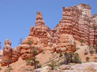 |
Click here to see a geologic image tour of Bryce Canyon National Park. Website images include both standard photograph and 3D views (as anaglyphs - requiring red-and-cyan 3D viewing glasses). This view shows the Claron Formation taken along the Mossy Cave Trail area along Highway 12 in Bryce Canyon National Park. To learn more about Bryce Canyon National Park check out the National Park Service website at http://www.nps.gov/brca. |
|
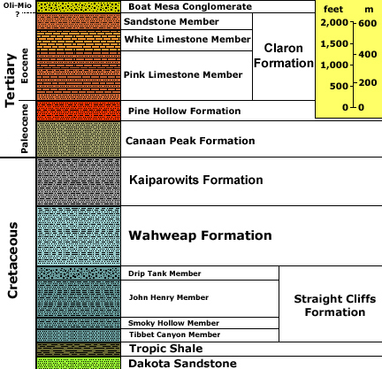
Generalized stratigraphy after ,
Davis, G. H. and Pollock, G. L., 2000, Geology of Bryce Canyon
National Park, Grand County, Utah: In Geology of Utah's Parks and Monuments,
Sprinkel, D.A., Chidsey, T. C., and Anderson, P. B., editors, Utah Geological
Association Publication 28., p. 37-60.
Stratigraphic unit information is modified from the USGS GeoLex (Lexicon of Geology): http://ngmdb.usgs.gov/Geolex/geolex_qs.html. Information about the Geologic Time Scale is available at: https://gotbooks.miracosta.edu/gonp/coloradoplateau/timescale.htm. |