|
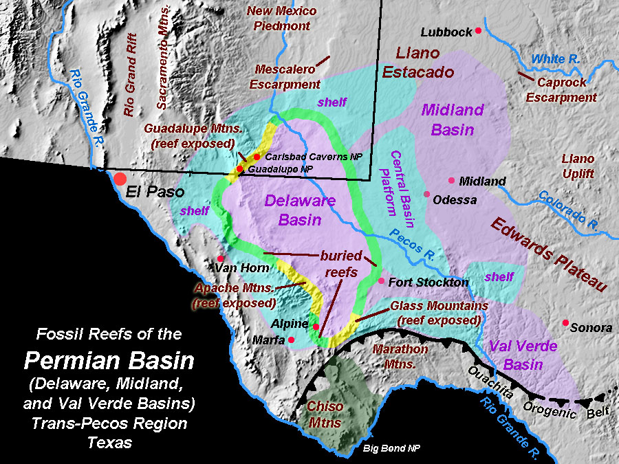
The Permian Basin is one of the largest sedimentary-filled basins in North America, located in West Texas and southeastern New Mexico (Figure 79). The Permian Basin is actually three interconnected basins, the Delaware, Midland, and Val Verde basins—separated by a central basin platform (a structural high in the middle of the larger basin). At the time the basin formed and filled, concurrent with the development of the Ouachita Orogenic Belt, the Permian Basin was a restricted seawater-filled foreland basin. The margins of the basins had shallow shelves where small to great organic reef tracks built up (such as the great Guadalupe Reef exposed in Guadalupe Mountains National Park). The Permian Basin had a link to the open ocean that allowed seawater to flow in. High evaporation rates, combined with the restricting geometry of the basin, allowed great quantities of salt to gradually fill the basins. The deepest parts of the sedimentary basin are in excess of 25,000 feet.
The Permian Basin has been one of the most prolific oil and gas-production regions in North America. Oil drilling and production in the region began in the 1920s, targeting petroleum reservoirs in buried reefs, reef flank deposits, and reservoirs on the basin’s central platform and shelf margins, and estimates of as much as 40 billion barrels of oil and liquefied natural gas have been extracted from the basin by the end of the 20th century. It is now considered a “mature” basin, with secondary oil recovery methods being used to prolong the life of old oil fields.
The basin is filled with great deposits of salt and anhydrite. Mining of gypsum, salt, and sylvite (potassium-chloride salt, also called “potash”) is also a large industry in the region. The salt deposits are part of the massive and extensive Castille Formation of Permian age.
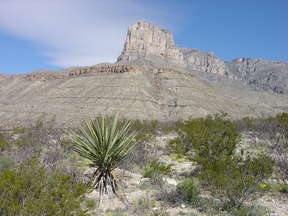
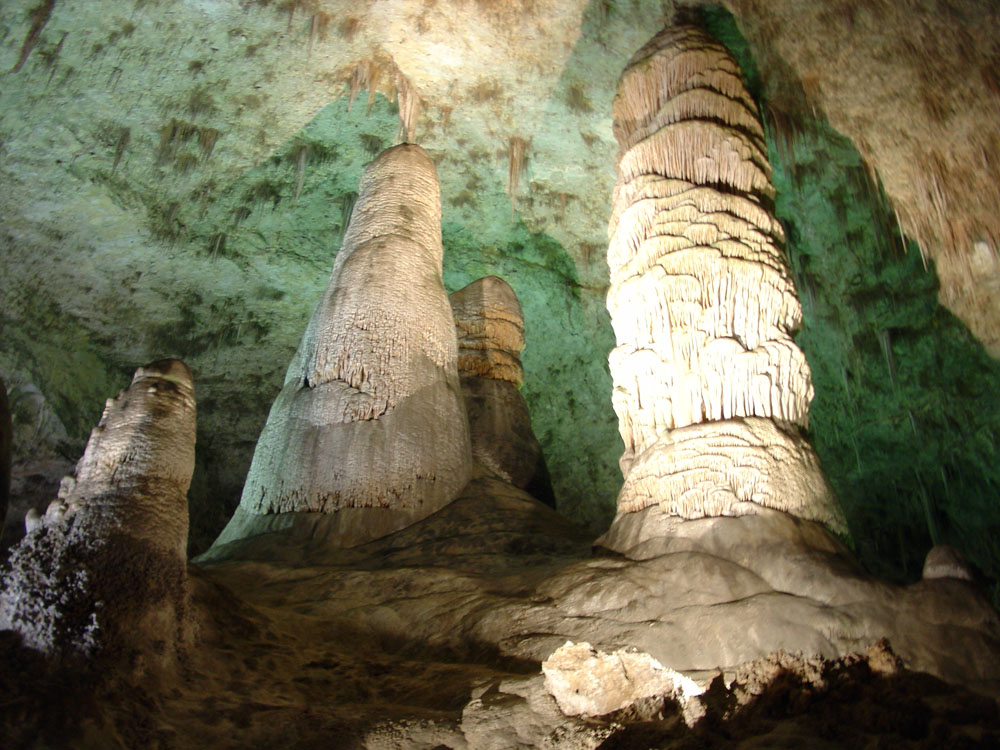
The massive Permian-age reefs exposed in the Guadalupe Mountains are integral to the scenery in Guadalupe Mountains National Park, Texas (Figure 80). The same reef track is host to Carlsbad Cavern National Park in the Guadalupe Mountains in southeast New Mexico (Figure 81). Carlsbad Caverns has been developed as a public-accessible "show caves" and is part of one of the largest cavern systems in North America. |