Regional Geology of North America |
|
The Great Lakes |
Click on images for a
larger view. |
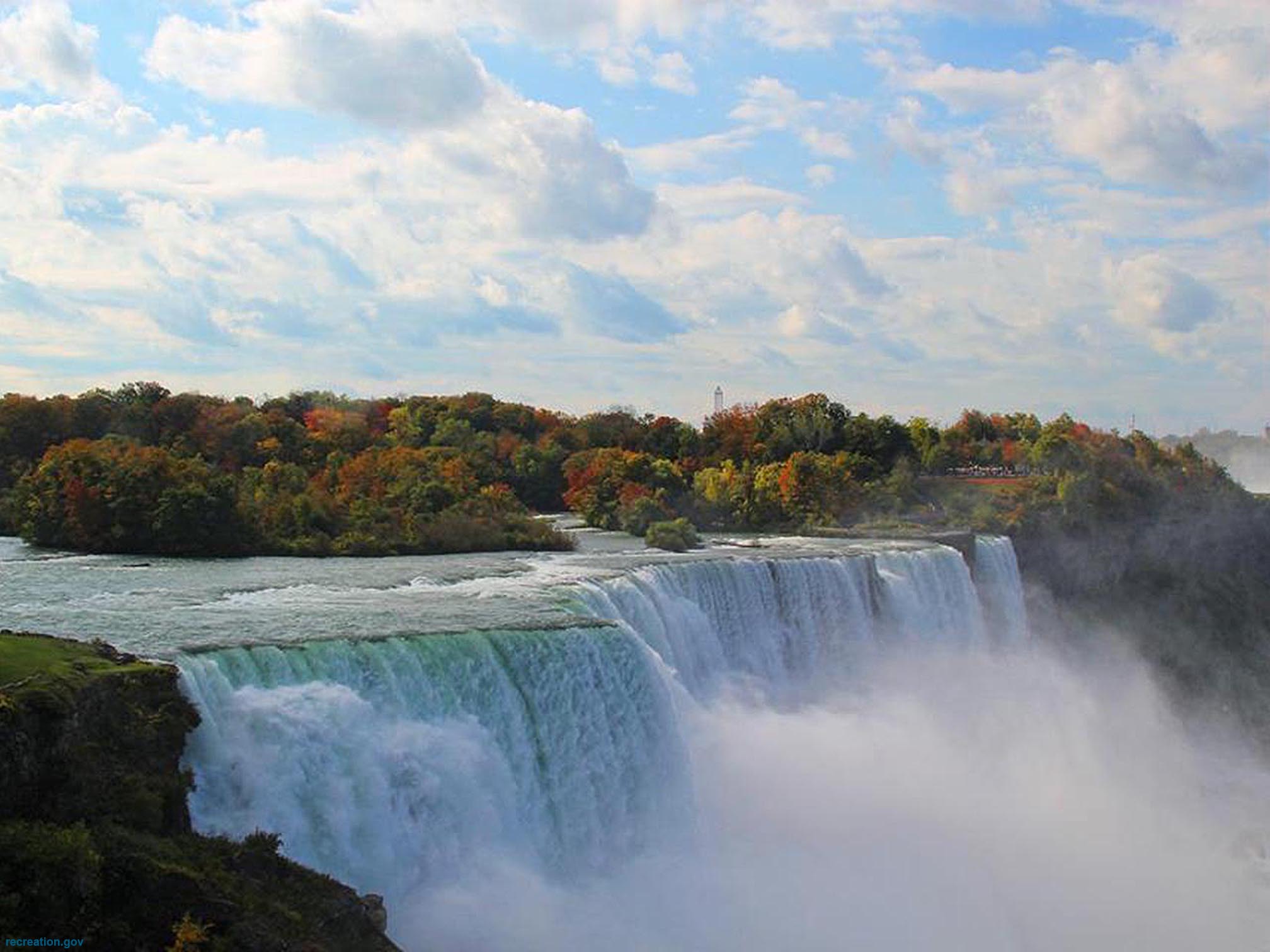
The Great Lakes are five interconnected freshwater lakes in the midwestern United States and Canada. The lakes drain eastward, connected to the Atlantic Ocean through the Saint Lawrence River (Figure 48). Lake Superior (elevation 591 feet) is the largest lake in the world—it is also the deepest of the lakes, averaging about 500 feet deep with the deepest point at 1,332 feet. Lake Michigan (the second largest), and is connected with Lake Huron (the third largest). Lake Michigan and Lake Huron have an average elevation 577 feet. The Detroit River connects Lake Huron to Lake Erie (a distance of 28 miles). Lake Erie (the fourth largest) has an average elevation of 571 feet. Lake Erie drains into the Niagara River and into Lake Ontario (the fifth largest, elevation 243 feet). Niagara Falls is on the Niagara River between Lake Erie and Lake Ontario (Figure 49). Lake Ontario drains into Saint Lawrence River.
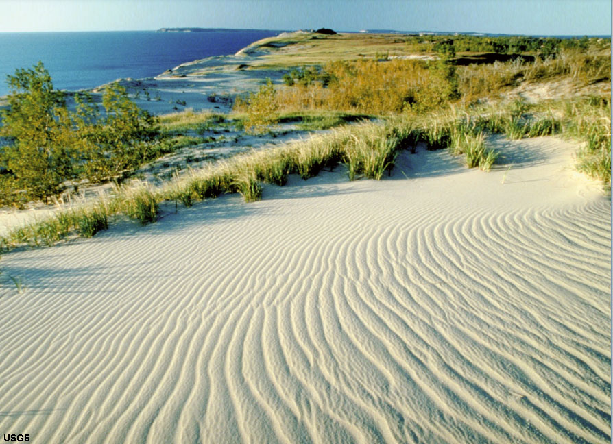
The Great Lakes formed as the last continental glaciers retreated northward about 14,000 years ago. The lake basins were carved by advancing ice sheets through the Pleistocene Epoch, scouring away the sedimentary cover over the Precambrian basement rocks and depositing the material as moraines and glacial till in the midwestern states to the south. Evidence of continental glaciation is exposed throughout the region, but exceptional exposures of glacial groves carved by the advancing glaciers are preserved on Kelleys Island in southern Lake Erie (Figure 50). Nearly 11,000 miles of coastline border the Great Lakes; the state of Michigan alone has 3,288 miles of coastline, only exceeded by the state of Alaska. Sleeping Bear Dunes National Lakeshore is an example pristine coastal dunes and shoreline habitats preserved along the shore of Lake Michigan (Figure 51).
|
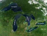
Fig. 48. The Great Lakes form the natural boundary between the Canadian Shield and the Mid Continent region of the United States. |
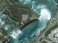
Fig. 49a. Aerial view of Niagara Falls on the Niagara River that drains between Lake Erie and Lake Ontario near Buffalo, New York. |
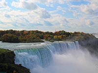
Fig. 49b. Niagara Falls is along the St. Lawrence River between Lake Erie and Lake Ontario.
|
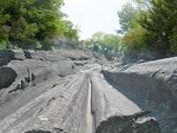
Fig. 50. Spectacular glacial grooves carved in limestone bedrock by continental ice sheets exposed on Kelleys Island in Lake Erie, Ohio. |

Fig. 51a. Airliner view of Chicago on the southwest shore of Lake Michigan.
|

Fig. 51b. Sleeping Bear Dunes National Lakeshore preserves dunes and coastal habitat along the coast of Lake Michigan in northern Michigan. |

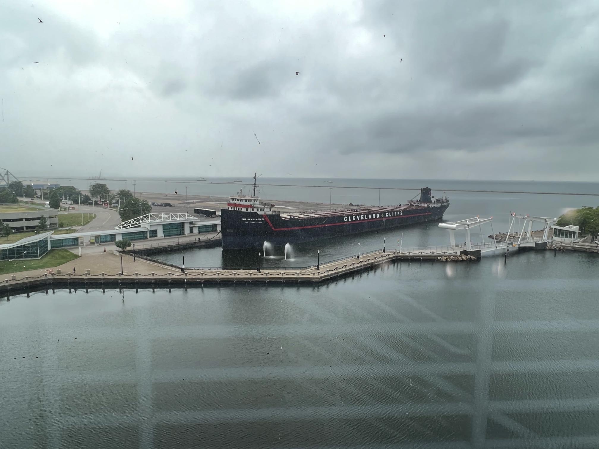
Fig. 51b. The Rock-N-Roll Hall of Fame is located in Cleveland on the shore of Lake Erie near the mouth of the Cuyahoga River.
|

Fig. 51c. View of Lake Erie as seen from the Rock-N-Roll Hall of Fame in Cleveland, Ohio. This view shows the kind of weather all too common near Lake Erie. |
|
| https://gotbooks.miracosta.edu/geology/regions/great_lakes.html 9/3/2022 |

|
 |
|
|