
Regional Geology of North America |
|
Great Basin Province |
Click on images for a
larger view. |
The Great Basin Province encompasses most of Nevada and parts of southern Oregon, western Utah, and parts of eastern California (see Figure 183). The physical geography of the region is well illustrated in Great Basin National Park, Nevada. The park displays a great range of ecological diversity ranging from grasslands and sagebrush desert to high alpine tundra, to high alpine tundra, with many ecozones and habitats in between (Figures 187 to 190). Most of Nevada is open rangeland. Highway 50 that crosses east-west across Nevada is called the "Loneliest Road in America" (in competition with Highway 93 that runs north-south across the state). Besides gambling and entertainment (Las Vegas style), the Great Basin region has a long history of ranching and mining development, primarily gold, silver, and other metals.
|
 |
 |
 |
 |
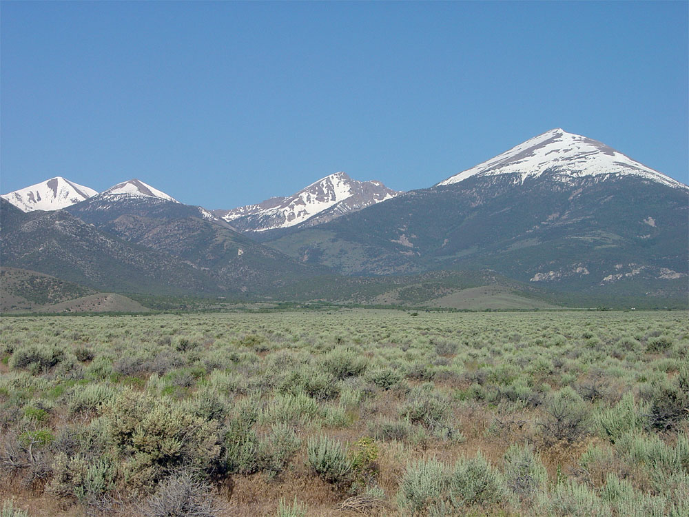
| Fig. 187. High peaks of the Snake Range rise above sagebrush desert in Hamlin Valley in Great Basin National Park, Nevada. |
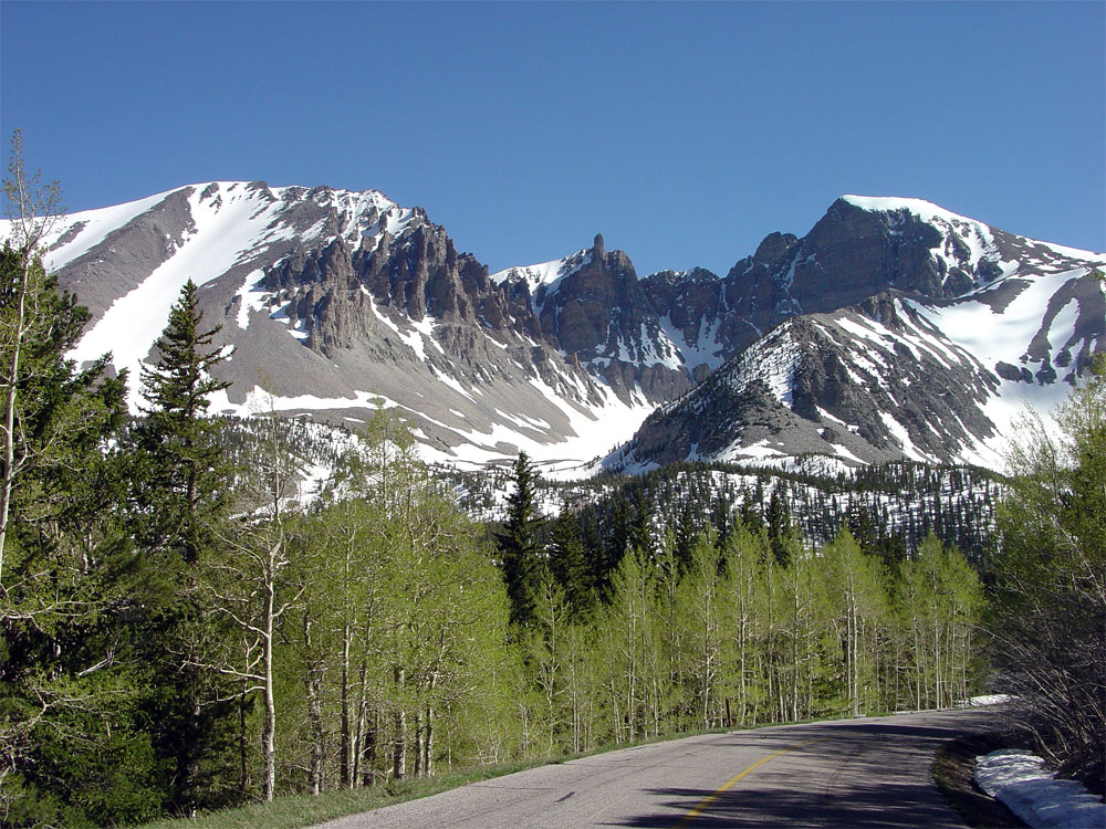
Fig. 188. Wheeler Peak (elevation 13,064 feet) is part of a glaciated highlands in the Snake Range in Great Basin National Park, Nevada. |
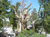
Fig. 189. Bristlecone pines on Wheeler Peak in Great Basin National Park have lived thousands of years in relatively cold, hostile conditions. |
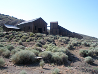
Fig. 190. A historic gold mine and a fossil marine reptile mine both are preserved in Berlin-Itchyosaur State Park, central Nevada. |
|
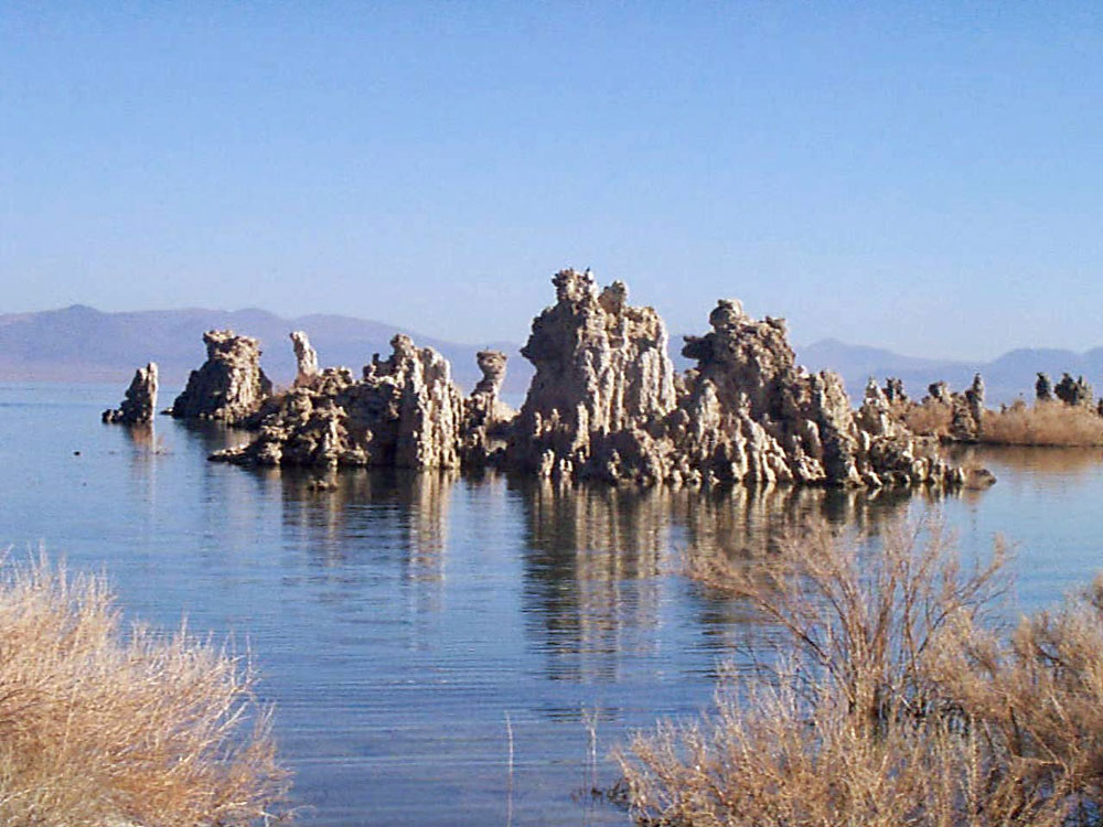
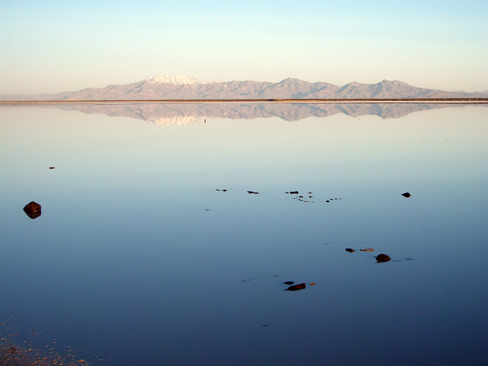
Traveling across the Great Basin is it easy to see remnants of the ancient shoreline features of the great lakes that once filled most of the basin areas (see Figure 186). Ancient Lake Lahonton filled the basins in western Nevada to depths as much as 900 feet at the peak of the last ice age, and was one of the largest lakes in North America. Mono Lake (east of Yosemite National Park) in California is a salt lake fills a valley that was once was a much greater drainage system that ended in Death Valley (Figure 191). The Great Salt Lake, Utah was once part of ancient Lake Bonnieville—at one time it was about 1,000 feet deep and perhaps the largest freshwater lake in the world. Today the lake is only 33 feet deep at its deepest point, and the western portion is now the Bonnieville Salt Flats (Figure 192).
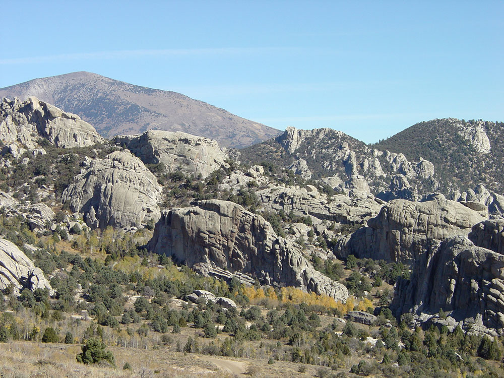
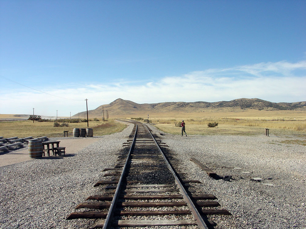
The region north of the Great Salt Lake is transitional to the Rocky Mountains, having characteristics of both provinces and has important history. Early settlers skirted around the rugged and arid lands of the Great Basin by following the California Trail (part of the route is preserved at City of Rocks National Reserve where trails converged near what is Almo in southern Idaho, Figure 193). The California Trail was heavily traveled in the summers from 1845 to 1869. History was then made at Promontory Point, a low range on the north side of Great Salt Lake where where in 1869 the Central Pacific Railroad Company of California (building east) joined the Union Pacific Railroad (building west), forming the First Transcontinental Railroad (now Golden Spike National Monument, Figure 194). |
 |
 |
 |
 |
| Fig. 191. Tufa towers in Mono Lake, a internally-drained basin on the west side of the Sierra Nevada that is 4-times saltier than the ocean. |
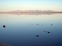
Fig. 192. Great Salt Lake covers the low eastern basin of the Great Basin west of the Wasatch Mountain front near Salt Lake City. |
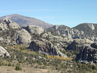
Fig. 193. Cretaceous-age granitic intrusions exposed in City of Rocks National Reserve, Idaho located in the transition zone with Rocky Mountains. |
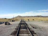
Fig. 194. Golden Spike NM (north of Great Salt Lake, Utah) is where the First Transcontinental Railroad was completed in 1869. |
|
| https://gotbooks.miracosta.edu/geology/regions/great_basin.html 1/20/2017 |

|
 |
|
|

