Regional Geology of North America |
|
Central Rocky Mountains and Wyoming Basins |
Click on images for a
larger view. |
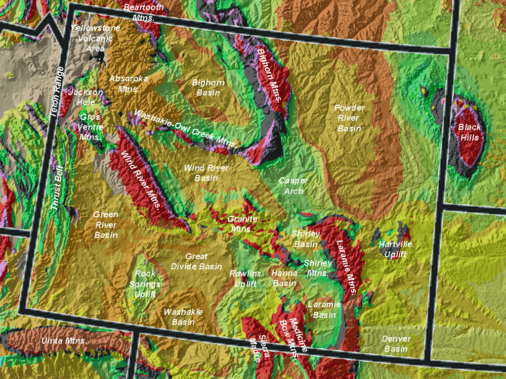
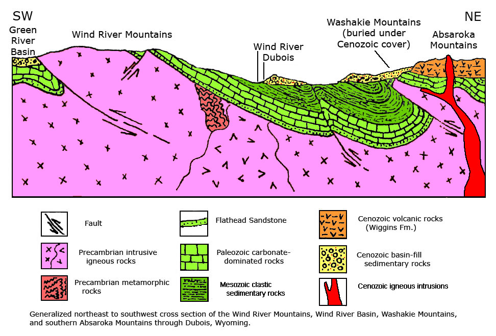
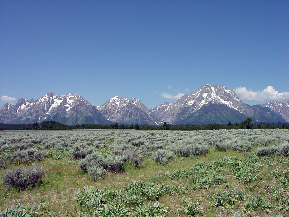
The Central Rocky Mountains include mountain ranges within and bordering Wyoming (Figure 113). The regions between mountain ranges are sedimentary basins that filled to overflowing during erosion periods of the Laramide Orogeny. Precambrian-age crystalline basement rocks (gneiss, schist, and granitic plutonic rocks) are exposed in the core of most of the ranges. Sedimentary rock formations of Paleozoic and Mesozoic age crop out on the flanks of the mountain ranges, including sedimentary beds deposited in the Western Interior Seaway. Brackish water lakes filled basin areas as the mountains were rising in Late Cretaceous to mid-Tertiary time (about 80 to 35 million years ago). The sedimentary basins are quite deep. Deformation during the Laramide Orogeny resulted in displacements in the range of 30,000-35,000 feet along fold and faults systems bordering uplifts in the Wyoming mountain ranges including the Wind River Mountains, Owl Creek Mountains, Bighorn Mountains, and others (Figure 114). For example, the rugged eastern face of Tetons Range in Grand Tetons National Park is an active normal fault scarp with nearly 35,000 feet of vertical displacement (most of the displacement is in the subsurface beneath Jackson Hole, the sediment-filled basin on the east side of the Tetons (Figure 115).
Despite the great amount of uplift, the elevations of the lakes that existed in the basins were still low, as illustrated by palm leaf fossils and other warm-climate species found in lake bed sediments of the Green River Basin (preserved in Fossil Butte National Monument near Kemmerer, Wyoming). Late in the Laramide Orogeny, volcanism resulted in the formation of the Absaroka Mountains about 35 million years ago.
Although Laramide deformation ended in mid-Tertiary time, erosion continued, filling the sedimentary basins and burying mountain ranges in their own sediments. Starting in late Tertiary time (Middle Miocene, about 20 million years ago), the entire region began to rise and erosion began to strip away sediments covering structures in the region. The region has risen more than a mile.
The region is being impacted by sub-crustal heat that is inflating the lower crust with molten material at depth.
Many of the rivers in Wyoming are antecedent streams—an antecedent stream is a stream that maintains its original course and erosional patterns despite the changes in underlying rock topography as the landscape is worn away. Rivers like the Wind River originally flowed eastward across a broad alluvial plain, but erosion over time has allowed to carve its canyon through the Owl Creek Mountains that were completely buried in sediments in mid-Tertiary time. Figures 116 to 122 illustrate landscape features of the central Wyoming ranges and basins. |
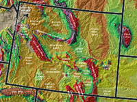
Fig. 113. Wyoming mountain ranges, uplifts, and sediment-filled basins. Lowland basins between are similar in character to the High Plains region. |
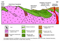
Fig. 114. Cross section through the Wind River Mountains, Wind River Basin, Washakie-Owl Creek, and Absaroka Ranges in northwest Wyoming. |
 |
 |
 |
 |
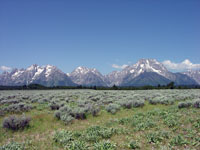
| Fig. 115. The Grand Tetons NP are a great block-faulted mountain range, adjacent to Jackson Hole (a basin) in northwestern Wyoming. |
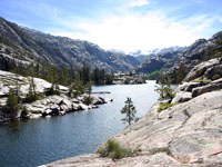
Fig. 116. Torrey Canyon is in the glaciated core of the Wind River Mountains, Wyoming, exposing rocks almost 3 billion years old. |
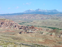
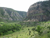
Fig. 117. View of the northwest end of the Wind River Basin with the volcanic Absaroka Mountains to the north, Wyoming. |
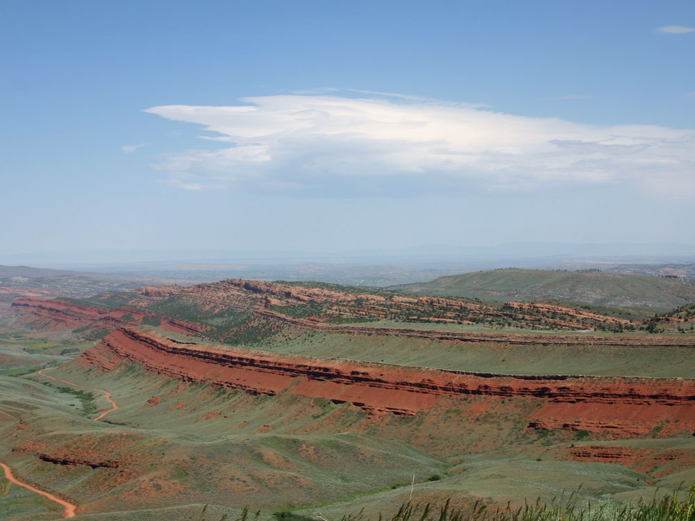
Fig. 118. Red beds of the Triassic Chugwater Group exposed on the northern flank of the Wind River Mountains near Lander, Wyoming. |
|
 |
 |
 |
 |
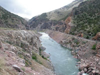
| Fig. 119. Wind River Canyon cuts through Precambrian rocks exposed in the core of the Owl Creek Mountains Wyoming. |
Fig. 120. Tensleep Canyon cuts through Paleozoic strata on the west flank of the Bighorn Mountains, Wyoming. |
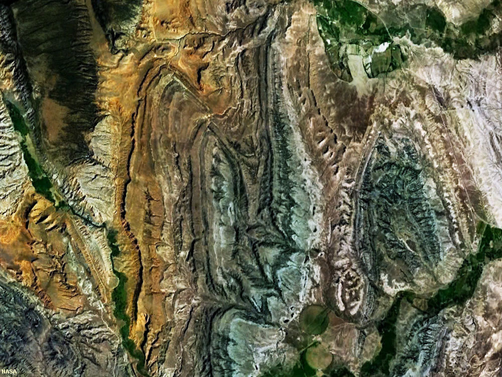
Fig. 121. Folded layers of Paleozoic and Mesozoic strata crop out along the southern Bighorn Mountains, Wyoming. |
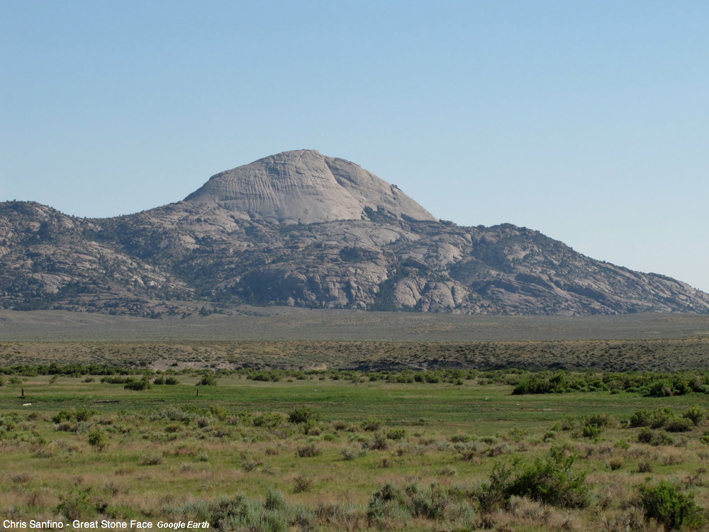
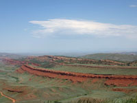
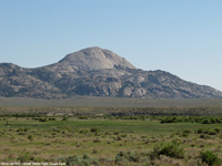
Fig. 122. Granite Mountains in central Wyoming formed in Late Cretaceous time, but are being re-exposed by erosion. |
|
| https://gotbooks.miracosta.edu/geology/regions/central_rocky_mountains.html 1/20/2017 |

|
 |
|
|