Regional Geology of North America |
|
Cascades Province |
Click on images for a
larger view. |
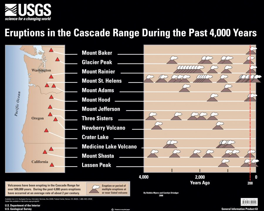
The Cascades Range extends from British Columbia southward into Northern California. The Cascades Provinces are generally subdivided into into the Northern, Central, and Southern provinces, but they all share the same characteristics: a long history of active plate-margin tectonics, intermittent volcanic eruptions, tectonism and earthquakes, and erosion. The Cascades are a belt of "geologically young and active" volcanoes associated with the Cascadia subduction zone along the northern West Coast. The Cascadia subduction zone is not only responsible for the volcanoes in the region, but is a source of great concern for great earthquakes (and tsunamis) that may impact the region. Figure 234 shows the region's major "active" volcanoes—those that have erupted in the past 4,000 years, numerous times!
The modern Cascades volcanoes rise above a landscape that has experiences volcanic activity going back into the Mesozoic Era. Volcanoes in the region have the tendency to build up, explode, collapse, and then rebuild themselves. At the same time, faults in the region are quite active, and erosion is keeping pace, tearing down volcanoes and mountains, and rivers are dumping sediments at sea.
|
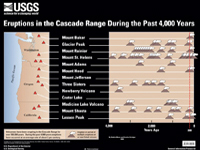
Fig. 234.Volcanic eruptions in the Cascades over the past 4,000 years. |
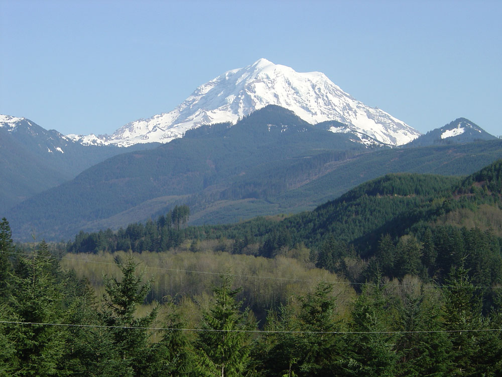
Mt. Rainier (in Mt. Rainier National Park, elevation 14,416 feet, and changing) is the highest volcano in the Cascade Rage—it is very scenic feature, but it is perhaps the most dangerous volcano in the United States (Figure 235). The last "significant" eruption of Mt. Rainier occurred in 1894, but the mountain is capable, like other Cascade volcanoes, of producing eruptions and collapse-related floods that could significant change the landscape in the region. The "problem" is that currently about 10,000,000 people live within the "impact zone" if Mt. Rainier were to have a major eruption and collapse that would send sediment-laden floods (lahars) into populated areas around Seattle and Tacoma (along with clouds of ash and gas). It has already happened before... numerous times in the recent geologic past.
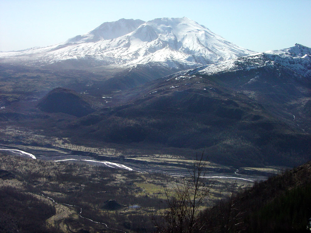
Mount St. Helens is "currently" (over the last 4,000 years) the most active volcano in the Cascades Range (Figure 236). The massive eruption of May 18, 1980 was the largest eruption in modern history of the Cascades, but was insignificant compared to other major eruptions that have occurred in pre-historic times. During the eruption about 1/4 cubic mile of volcanic material was blow out of the volcano, most associated by a massive landslide that collapsed a side of the volcano. Geologist have found evidence of eruptions in the region that may have moved hundreds to thousands of times that volume in the past.
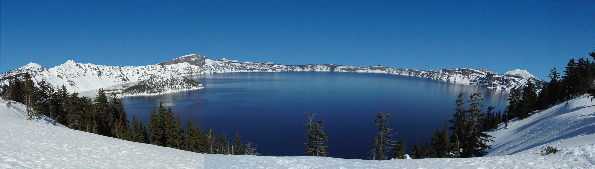
Crater Lake National Park in southern Oregon is host to the deepest (and cleanest) freshwater lake in North America (about 2,000 feet deep)(Figure 237). Crater Lake fills the caldera that formed on ancient Mt. Mazama that erupted and collapsed internally to form the crater (caldera) about 9,000 years ago. |
Cascade Volcanoes in Northern California
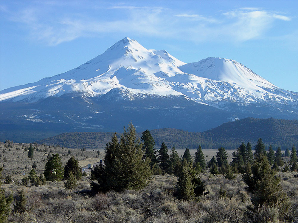
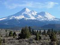
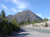
The Cascades in northern California are the transition zone to the more ancient volcanic arc preserved as rocks in the Sierra Nevada Range to the south. Mount Shasta is the second highest of the Cascade volcanoes (elevation 14, 179 feet, and changing), but by volume it is the largest. It is a large composite cone, having numerous vents that have contributed to the buildup of the large stratovolcano (Figure 238). Black Butte is a "satellite volcano" on the margins of Mt. Shasta; it is located along Interstate 5 (easily visible) near Weed, California. Black Butte is a "lava dome" volcano about 9,000 years ago (Figure 239).
Lassen Volcano is the southernmost active volcano in the Cascade Range in northern California. Lassen Peak experience a series of eruptions from 1914 to 1917, with the largest happening in 1915. The volcano is now preserved as Lassen Volcanic National Park.
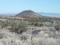
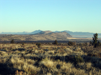
Medicine Lake Volcano is the most expansive volcano in the Cascade Range. It is a large shield volcano that covers a large area in northeastern California. Lava Beds National Monument preserves part of the Medicine Lake Volcano Field (Figures 240 and 241).
|
 |
 |
 |
 |
| Fig. 238. Mount Shasta in northern California is the largest of the Cascades volcanoes. |
Fig. 239. Black Butte, a lava dome volcano along Interstate 5 near Weed, California. |
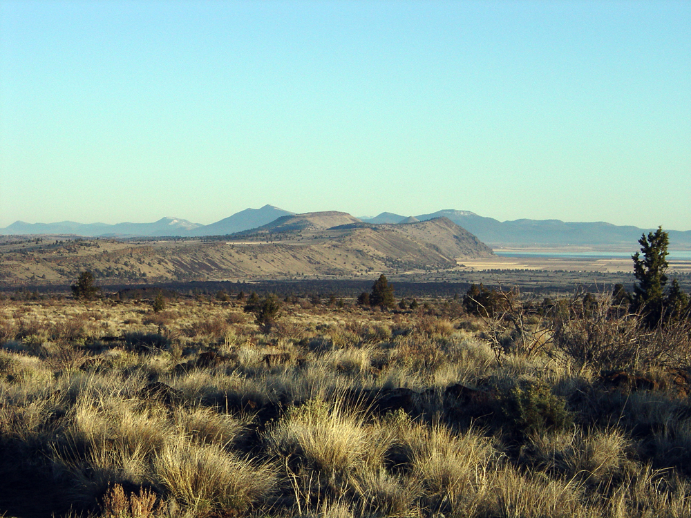
Fig. 240. Schonchin Butte (a "young" cinder cone) in Lava Beds National Monument. |
Fig. 241. Tule Lake Valley is in a fault bounded graben in Lava Beds National Monument. |
|
| https://gotbooks.miracosta.edu/geology/regions/cascades.html 1/20/2017 |

|
 |
|
|