
Regional Geology of North America |
Appalachian Plateaus Province |
Click on images for a |
|
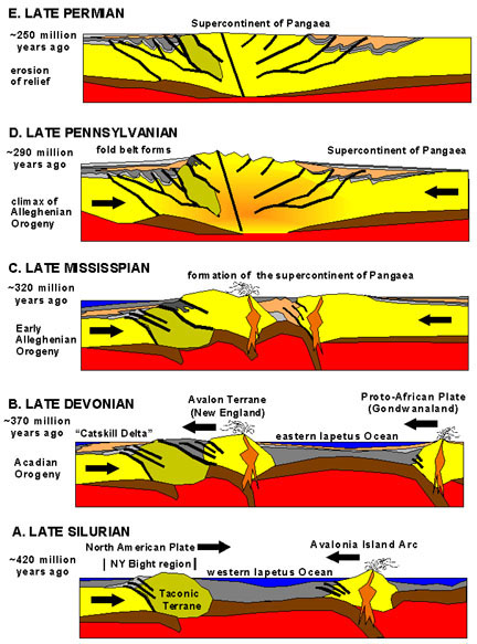
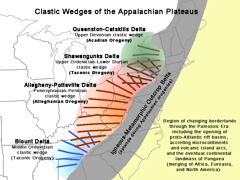
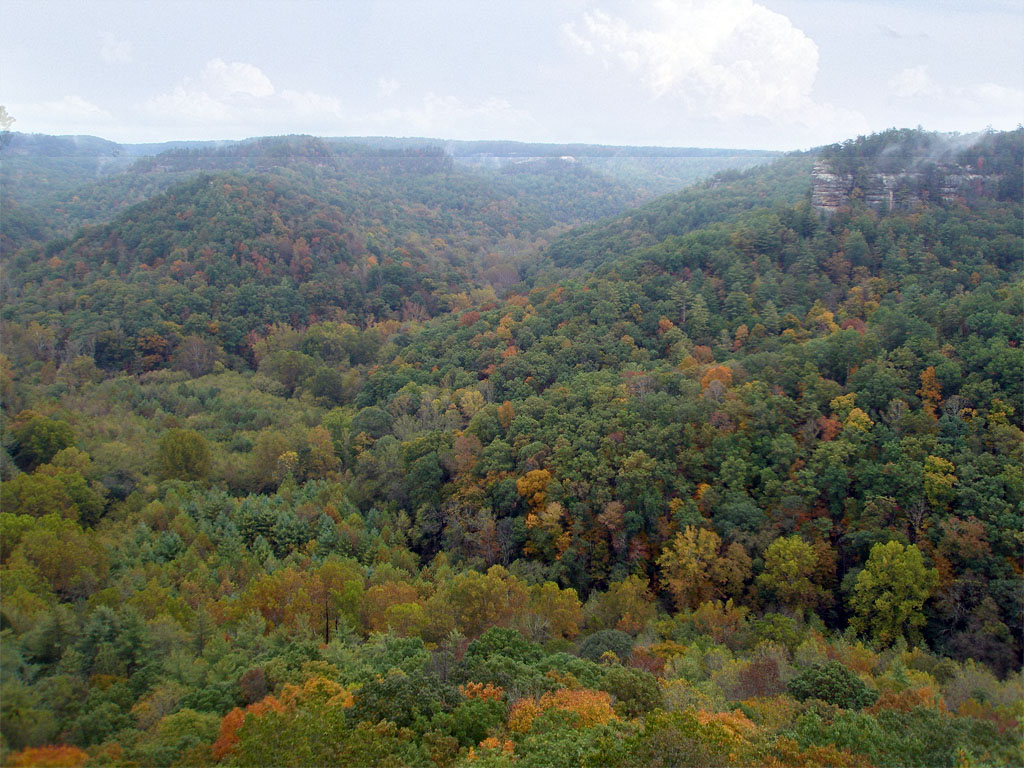
The Appalachian Plateaus Province is the northeastern side of the greater Appalachian Mountains region (or the Appalachian Basin, the thick underlying sedimentary basin that underlies the Appalachian Mountains region). The Appalachian Plateau Province extends from Alabama to New York (see Figures 21 and 22). The province is subdivided into several separate plateau regions including the Cumberland Plateau (Tennessee-Kentucky), Allegheny Plateau (West Virginia-Pennsylvanian-Ohio), Catskills and Pocono Mountains (New York-Pennsylvania), and Mohawk Plateau (in the Finger Lakes region in upstate New York). These mountainous regions are actually erosionally dissected plateaus, having ridge lines that basically have generally similar elevation throughout. The eastern sides of each of these regions are characterized by a high escarpments that borders the Valley and Ridge Province. The Catskills-Mural Front is a steep escarpment on the east side of the Catskills, overlooking the Hudson River Valley (Figure 36). The Allegheny Front is an east facing escarpment along the Allegheny Mountains in Pennsylvania, Maryland, and West Virginia, and the Cumberland Mountains of southeastern Kentucky form an east-facing escarpment bordering the Valley and Ridge region of western Virginia and eastern Tennessee. Three mountain-building episodes in the Paleozoic Era resulted in the formation of great regional delta systems that spread westward onto the North American mid continent. These mountain-build periods include the Taconic Orogeny (Ordovician-Silurian time), Acadian Orogeny (Devonian), and Allegheny Orogeny (Pennsylvanian-Permian) (Figures 37 and 38). These orogenies are associated with collisions of smaller landmasses that accreted onto the North American continental margin and the eventual collisions of Africa, Europe, and North America to form the supercontinent Pangaea at the end of the Paleozoic Era. The bedrock of the adjacent Appalachian Plateaus consist of a series of overlapping “clastic wedges” associated with ancient delta systems of rivers that drained from the mountainous highlands that existed to the east along what is now the Atlantic continental margin region (Figure 39). The ancient delta systems on the western side of the ancestral Appalachian Mountains spread westward, forming broad swamplands and river floodplains that spread into shallow inland seas that covered much of the midcontinent region throughout the Paleozoic Era. These ancient delta-swamplands deposits are host to the extensive coal fields of Pennsylvanian age throughout the Appalachian Plateau region. Deposits from ancient river delta and coastal plains along the interior shallow seaways are host to the coal fields of West Virginia, Kentucky, Indiana, Illinois, and as far west as Missouri and eastern Kansas. Sandstone beds of Pennsylvanian age cap the Cumberland Plateau region, and are well exposed in the Red River Gorge National Geologic Area, Kentucky (Figure 40). |
 |
 |
| Fig. 37. Paleozoic mountain-building periods include the Taconic, Acadian, and Allegheny orogenies, leading to formation of Pangaea. | Fig. 38. Breakup of Pangaea and formation of the modern Atlantic Ocean and the passive continental margin in Mesozoic and Cenozoic time. | |
 |
 |
|
| Fig. 39. Clastic wedges (ancient delta systems) associated with orogenies that provided sediments to the Appalachian Plateaus Province. The ancient deltas expanded westward filling in shallow seaways in the North American midcontinent region. | Fig. 40. Red River Gorge is incised into the Cumberland Plateau in southeastern Kentucky (central part of the Appalachian Plateaus). Conglomeratic sandstones form the caprock throughout the entire Applalachian Plateaus region. |
| The landscape of the Appalachian Plateau of the consists erosionally dissected plateaus and mesas (Figure 40A). The caprocks of the regions mesas and plateaus mostly consist erosionally resistant bed of sandstone and conglomerate. Bedrock exposed in the region consists of flat-lying to gently-dipping sedimentary rock formations of Late Paleozoic age (Late Devonian to Early Permian age) with older rocks not exposed at the surface. Only the northern margin of the plateau in Ohio, Pennsylvanian and New York experience glaciation during the Ice Ages, the southern region was unglaciated. Today much of the region remains forested and drained by stream that drain south into the Ohio River and into Lake Erie and Lake Ontario (to the north). | 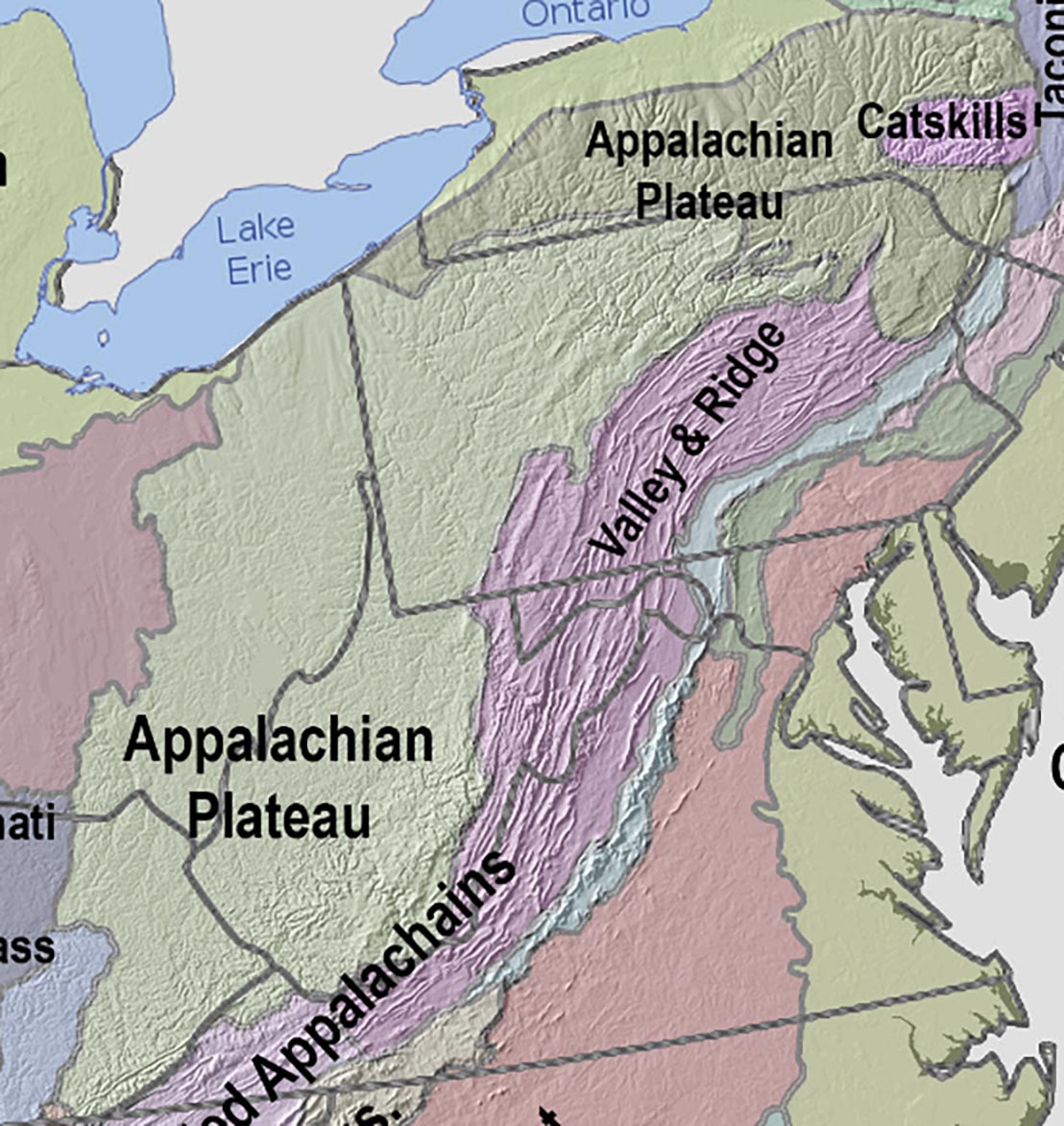 Fig. 40A. Map of the Appalachian Plateau showing shaded relief |
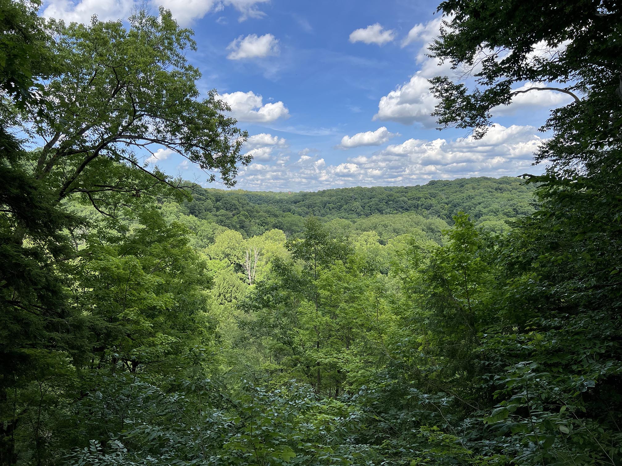 Figu 40B. Northern Appalachian Plateau in Cuyahoga Valley NP, Ohio. |
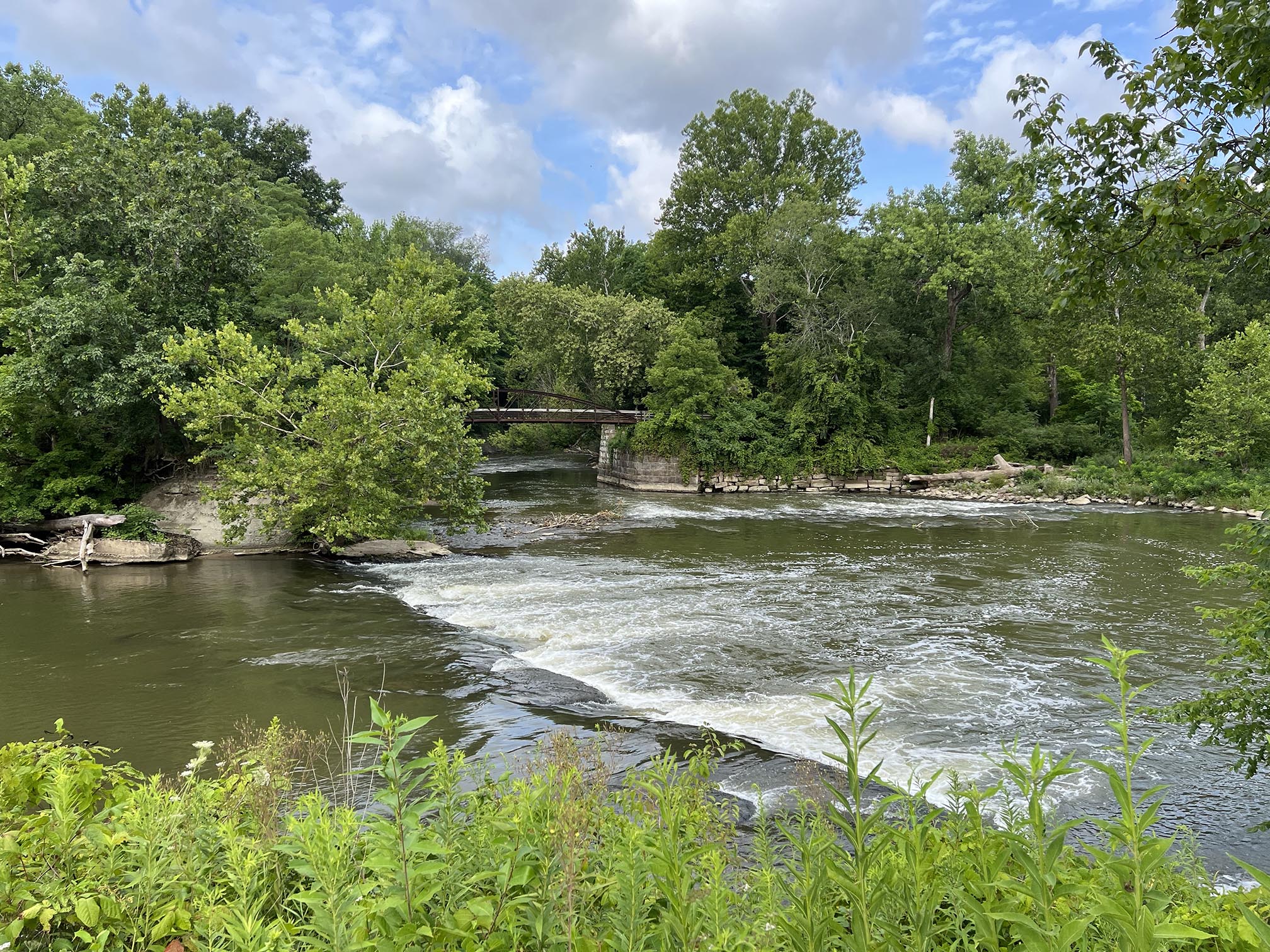 Fig. 40C. Rapids on the Cuyahoga River in Cuyahoga Valley NP, Ohio. |
| https://gotbooks.miracosta.edu/geology/regions/appalachian_plateau.html 9/2/2022 |