|
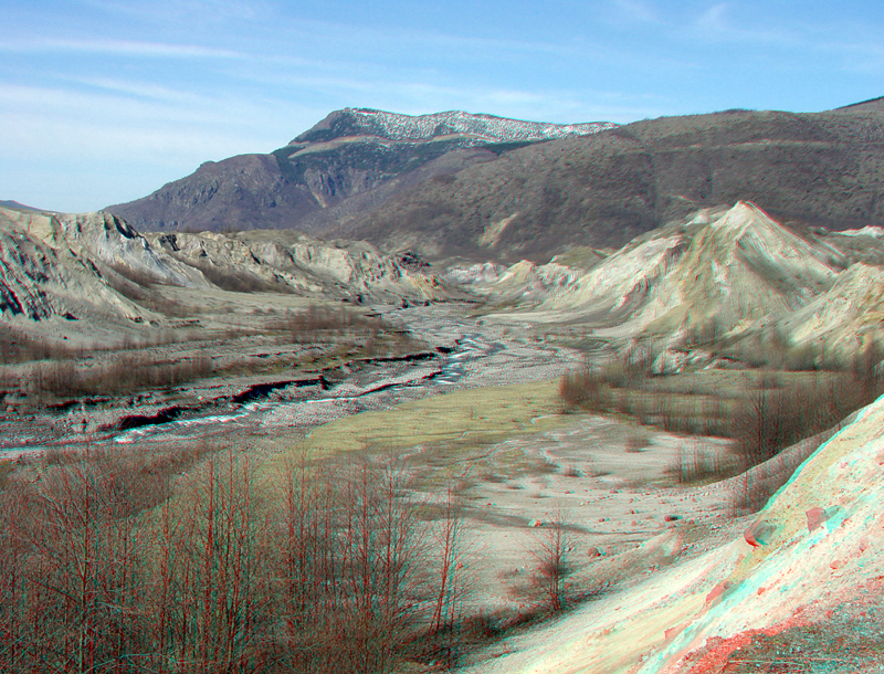
| This riverside view is looking downstream along the Toutle River valley (North Fork). Bluffs along the river rise nearly 200 feet (60 meters) above the active stream channel. This valley is a testament of the power of stream erosion (particularly during flood). This sediment is migrating downstream. A large artificial sediment retention dam was constructed across the valley of the North Fork of the Toutle River upstream of the communities along the Interstate 5 corridor in western Washington. |
|
The URL is: https://gotbooks.miracosta.edu/gonp/sthelens/html/msh625.htm Last modified: 1/6/2011 |