|
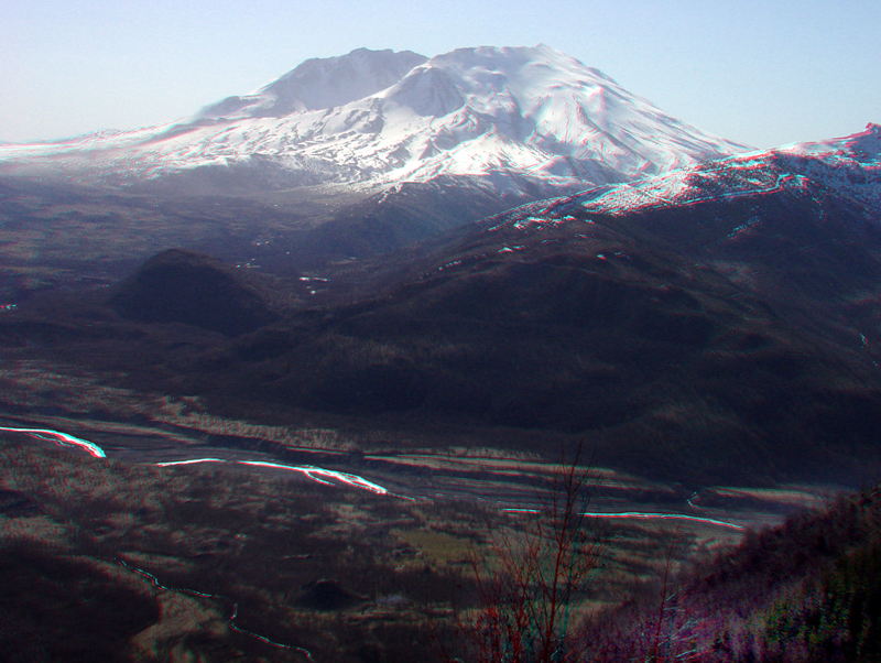
| This zoomed-in view from near the Forest Learning Center along WA Highway 504 shows the north flank of Mount St. Helens and the volcanic resurgent dome that built up following the massive collapse of the mountain in 1980. The top of the dome is still below the mountain's high south rim that represents the escarpment that formed from the collapse of the volcano that began on May 18th, 1980. |
|
The URL is: https://gotbooks.miracosta.edu/gonp/sthelens/html/msh583.htm Last modified: 1/6/2011 |