|
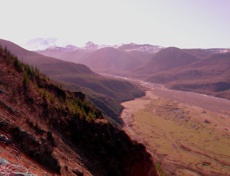
| This view taken along WA Highway 504 shows the sediment-clogged valley of the North Fork of the Toutle River. The image shows the active stream channels in low flow. The active flood plain has a brownish-gray appearance whereas the relatively undisturbed surface of the 1980 flow has a thin, green vegetative cover and has numerous pools that have not yet developed a surface drainage network. Mount St. Helens is in the upper left-hand corner. |
|
The URL is: https://gotbooks.miracosta.edu/gonp/sthelens/html/msh572.htm Last modified: 1/6/2011 |