Click here to start a 3D
tour of the Red River Gorge Geological Area in southwestern Kentucky.
You will need 3-D glasses to view this series of anaglyphic
images.
Click on any of the images to continue to the next page in the linked series of web pages.
|
|
 |
This website contains images produced from stereo photo pairs that were manipulated into anaglyphs (3-D images). You will need red-and-cyan stereo viewing glasses to get the 3-D visual effects. |
|
Click here to see the same images in standard photography. |
|
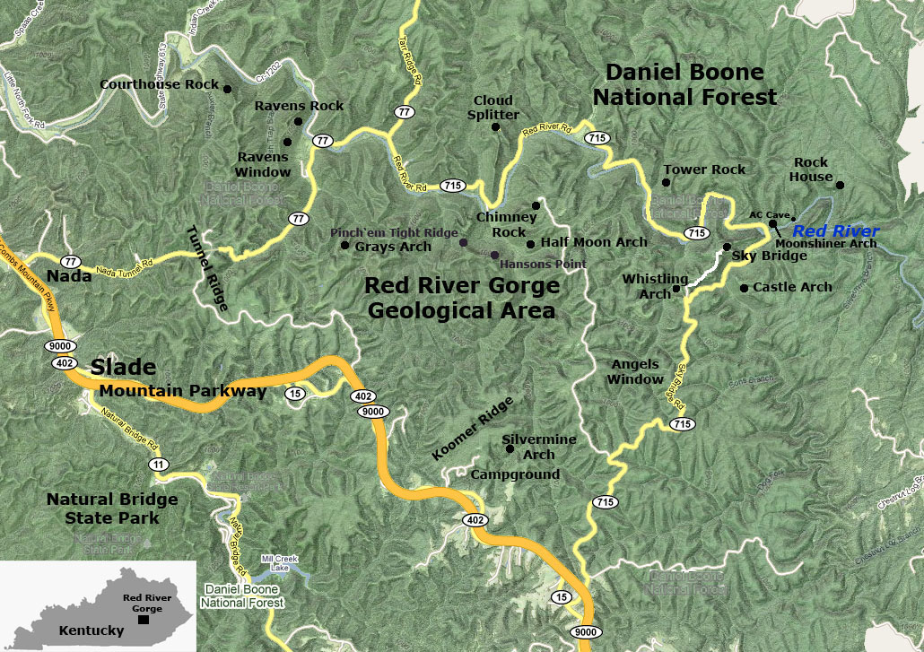
More than 150 natural arches and bridges are known in the Red River Gorge area of Kentucky. Because of the unique quality and abundance of arches, archeology, and natural history, this area is preserved as the Red River Gorge Geological Area within Daniel Boone National Forest. Natural Bridge State Park is famous for it long span natural arch. |
Click here to see more 3-D geology tours of National Parks.
Click here to see selected references.| This page is <https://gotbooks.miracosta.edu/gonp/rrgga/> Last modified Mon 11/22/2010 |