|
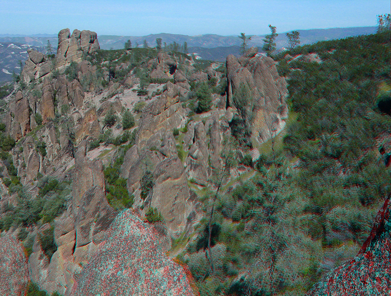
| Note the boundary between pinnacles-style outcrops on the left and forested slopes on the right. The reason for this change is unclear, however, geologists look for such transitional boundaries. They may represent faults, changes in geologic strata, boundaries of igneous intrusions, or other features. What is obvious is that the physical and chemical processes breaking down the rock are different on either side of this boundary. This view is along the upper Condor Gulch Trail. |