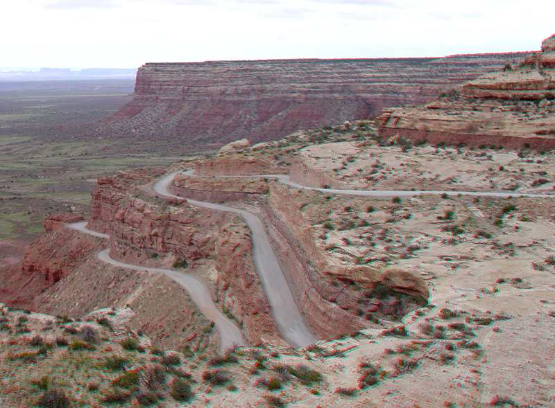
| The Moki Dugway is part of Highway 261 about 24 miles south of Natural Bridges National Monument. The Moki Dugway gets its name from the carved hand- and foot-holds on cliff faces throughout the region created by the ancient American Indians. Worn step-like paths can be found leading up cliffs to food storage areas, dwellings, springs, or up steep escarpments like the one shown here. This view shows switchbacks and the modern highway cuts along Utah Highway 261 where the highway crosses the southern escarpment of Cedar Mesa. The Cedar Mesa Sandstone of Early Permian age form cliffs and the cap rock rim of the mesa (or plateau within the greater Colorado Plateau). The lower slopes consist softer sandstones, siltstones and shales of the massive Halgaito Formation of Late Pennyslvanian age. The valley below is underlain by an older marine sedimentary formation, the Honaker Trail Formation of Late Pennsylvanian age. The Honaker Trail Formation is exposed in the valley of the San Juan River along the northern boundary of the Navajo Reservation (Stevenson, 2000). |