
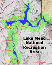
Once the dam was completed, the reservoir was filled slowly over a 6.5 year period. The slow filling process was required to allow the bedrock and dam to adjust to the pressure of water filling the canyon. Lake Mead's deepest point is about 590 feet (181 meters). The lake varies in size with water level, but at high water levels Lake Mead covers about 250 square miles and extends up river for 110 miles (176 km) into Grand Canyon (U.S. Bureau of Reclamation, 1941; U.S. Bureau of Reclamation, 2010).