 |
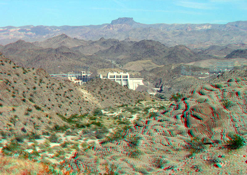
This view is looking east toward Davis Dam along old Nevada Highway 68 to Davis Dam (the highway route across Davis Dam was abandoned in 2004). The rugged landscape of the southern Black Mountains (of Arizona) and Newberry Mountains (of Nevada) consists of Miocene-age granitic igneous intrusions and volcanic deposits that locally cross-cut and overly ancient (Precambrian-age) crystalline basement rocks (metamorphic and granitic rocks) (Volborth, 1973). The high peak in the distance is the Princess's Necklace. The peak is in the Black Mountains east of the Katherine Mine and has an elevation of 4,827 feet (1,471 meters). |