 |
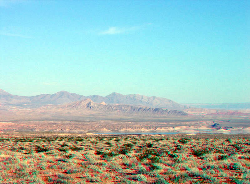
This view is looking east from near the park boundary near milepost 43 on the Northshore Road. The northern end of the Overton Arm of Lake Mead is at the end of a long alluvial fan and pediment system that drains from the Virgin Mountains (to the east) and the Muddy Mountains (to the west). Bitter Ridge, the dark ridge of steeply dipping Paleozoic-age sedimentary rocks on the opposite side of the lake. These hard, erosionally resistant rocks rise above the surrounding alluvial plain. Beyond Black Ridge is South Virgin Peak Ridge (of the southern Virgin Mountains). The Virgin Mountains consist mostly of sedimentary rocks of Paleozoic age (Late Cambrian, roughly 520 million years, to Early Permian, about 270 million years). Badlands of eroding late Miocene-to-Quaternary-age basin-fill sediments occur along the lake shore (Beard and others, 2007). |