 |
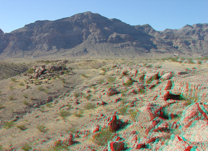
This view is looking north along the edge of a low escarpment of Quaternary-age caprock along one of the tributaries of Echo Wash. The caprock is a fossil desert soil called calcrete (or caliche). Calcrete forms from sediments that are tightly cemented by calcium carbonate and clay from the infrequent wetting and drying of sediments on an alluvial fan surface. Calcrete is abundant in areas where carbonate rocks (limestone and dolomite) are abundant in stream source areas. In this view, the south face of Long Wall Ridge is in the distance. The escarpment consists of Paleozoic-age rock formations, mostly limestone beds of Devonian and Mississippian in age (Beard and others, 2007). This image was taken along the Echo Bay access road about one mile south of the intersection with the Northshore Road. |