 |
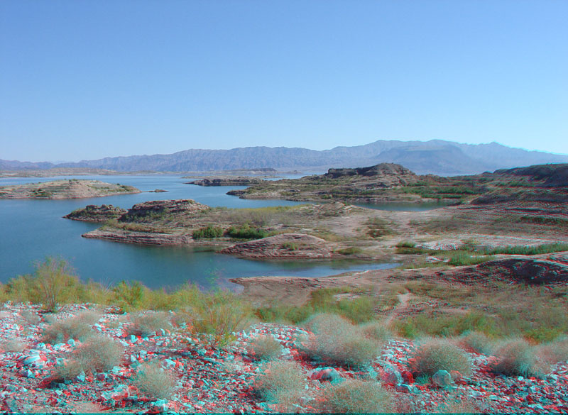
This view is looking west from Rocky Point Overlook (part of 33 Hole Overlook near milepost 8 on Lakeshore Scenic Drive). Islands and bluffs along the lakeshore consist of continental sedimentary deposits of the Muddy Creek Formation (Late Miocene age, about 5 to 11 million years old) (Beard and others, 2007). The northern Black Mountains on the Arizona side of the lake are visible in the distance. The Colorado River (now Lake Mead) flows through the Narrows of Boulder Canyon located in the low gap at the north end of the Black Mountains in this view. |