 |
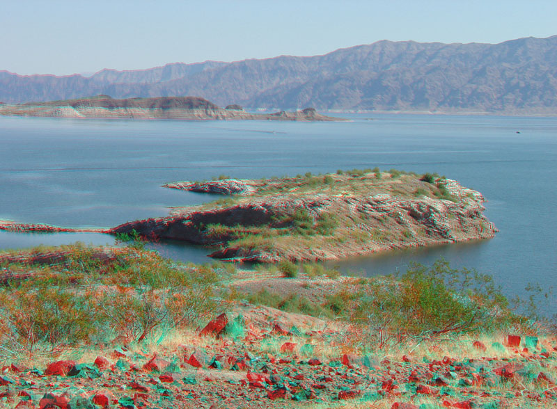
This view is looking east from Sunset Point (near milepost 7 on Lakeshore Scenic Drive). Boulder Basin is the large open part of Lake Mead's west end. Lake Miocene-age continental sediments are exposed along the lake's western shore and on nearby islands. These sediments are grouped into the Muddy Creek Formation and represent sediments deposited on alluvial fans, stream floodplain and channel deposits that accumulated between 11 and 5 million years ago. The northern Black Mountains in the distance are a great volcanic intrusive complex called the Wilson Ridge pluton. The Wilson Ridge pluton formed between 14 and 12 million years. This was during a period when extensional tectonic forces were shaping the basin and range structure of the Basin and Range Province between about 18 to 11 million years ago. Volcanism ended, but erosion and tectonic motion along regional fault systems has continued to the present (Beard and others, 2010). |