[Note: Hit the "back" key to return to the previous tour image.]
|
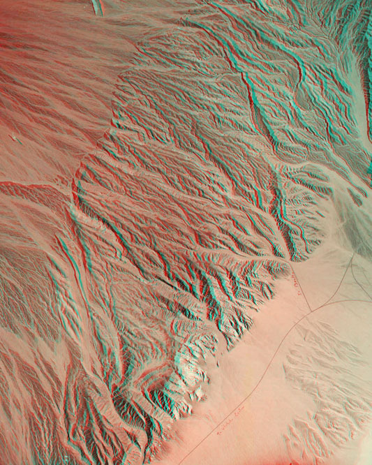
| Beatty Junction is a crossroads where highways 190, 267, and 374 come
together near the historic location of the orginal Stovepipe Wells ( the
location of springs on Mesquite Flat are to the right of this image). This view reveals
how the ongoing uplift of the part of the mountain front is creating an
incised pediment while alluvial fan systems continue to develop both above
and below the fault-bounded uplfited area that runs diagonally across
this image. North Highway (267) toward Scotty's Castle exits at the bottom
center of the image. Scale (1:48,000); north is to the left. [Note: Hit the "back" key to return to the previous tour image.] |