|
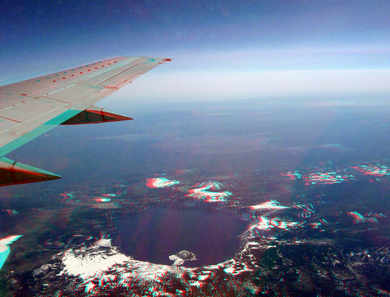
| Aerial view of Crater Lake taken from a flight between San Jose and Seattle at about 30,000 feet. The flight path basically follows the Cascade Range. This view is from the right side of the plane. Click here to see a panoramic view of Crater Lake from the south rim of the Crater (the south rim is on the lower right side of the lake in this image). |
|
The URL is: https://gotbooks.miracosta.edu/gonp/crla/html/aerial.htm Last modified: 8/19/2010 |