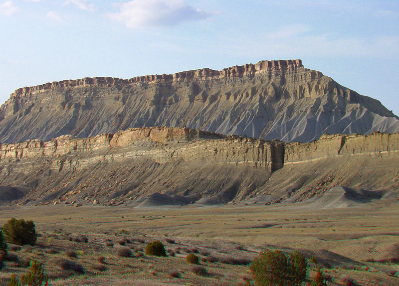
| Massive sandstone layers cap steep, barren, slope exposures of Mancos
Shale along the east side of the Strike Valley. The Mancos Shale formed
from marine sediments deposited in the Western Interior Seaway during
the Late Cretaceous period. At its maximum extent about 100 million years
ago, the Western Interior Seaway extended from the Arctic Ocean to the
Gulf, and extended from the Cordilleran mountain ranges in the Nevada
region eastward to the Mississippi Valley region (McGookey and others, 1972). This seaway disappeared
as the Laramide Orogeny uplifted the Rocky Mountain region beginning in
the latest Cretaceous to the early Tertiary, being replaced by smaller inland seas and waterways which gradually vanished with regional uplift and landscape changes that followed in the Tertiary Period (McDonald, 1972).
The region is still gradually rising today. The Mancos Shale can be subdivided
into units from lowest to highest shown here: The Tununk Shale underlies
the foreground valley;, the first ridge is the Ferron Sandstone Member; the
second valley and gray slope is the Blue Gate Shale Member, and the caprock
on the distant ridge is the Emery Sandstone Member; the uppermost Masuk Member (mostly shale) is not visible in this image (Morris and others, 2000). |