|
Click here to start a tour of Big Bend National Park. You will need 3-D glasses to view this series of anaglyphic images. Click on any of the images to continue to the next page in the linked series of web pages. |
|
|
|
Click here to see more geology tours of National Parks. |
|
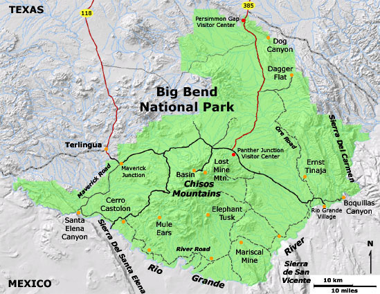
Click here to learn more about Big Bend National Park (National Park Service website: http://www.nps.gov/bibe). Click here to learn about the stratigraphy of Big Bend National Park. See an NPS overview of the Geology of Big Bend National Park. Click here for a list of maps, books, and historic reports that describe the geology and natural history of the Big Bend National Park (used in the construction of this website). Note that all photography on this website was taken in April, 2005. |
| Learn about USGS research in Big Bend National Park Gray, J. E. and Page W. R., eds., 2008, Geological, geochemical, and geophysical studies by the U.S. Geological Survey in Big Bend National Park, Texas: U.S. Geological Survey Circular 1327, 93 p. Available online at http://pubs.usgs.gov/circ/1327/ . |
 |
This website contains images produced from stereo photo pairs that were manipulated into anaglyphs (3D images). You will need red-and-cyan stereo viewing glasses to get the 3D visual effects. |
| This page is <https://gotbooks.miracosta.edu/gonp/bibe/> Last modified 1/3/2010 |