Regional Geology of North America |
|
Mojave Desert Province |
Click on images for a
larger view. |
The Mojave Desert Province encompasses a large portion of southern California and small parts of southern Nevada, Utah, and northwestern Arizona. The Mojave Desert displays basin and range topography, but differs from the rest of the Basin and Range Provinces based on geographic, climate, and biological factors.
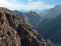
The north and boundaries of this triangular-shaped region is are basically topographic features associated with major faults in California, the Garlock Fault runs east-west along the south side of the Tehachapi Mountains. The south and side of the desert and the San Andreas Fault basically defines the boundary along the San Gabriel Mountains and San Bernardino Mountains (Figure 195). North and east is the Colorado Plateau and the Basin and Range Province of southern Arizona which is part of the Sonoran Desert.
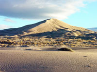
Like the Great Basin region to the north, the Mojave Desert Province is partly an internally drain basin region. During the last ice age, Mono Lake basin (ancient Lake Russell) drained through ancient lakes in Owens Valley, Panamint Valley, Searles Valley, and finally into Death Valley that was flooded by ancient Lake Manly to a depths as much as 600 feet. Today, the basins are host to dune fields and dry lake beds that only flood temporarily during intermittent wet periods. Further south, the ancestral Mojave River flowed into ancient Lake Mannix through a series of basins. Soda Lake and Silver dry lakes near Baker California are remnants of that drainage system (Figure 196). The Colorado River has also drained into the internal basins of southern California in the past, most recently into the Salton Sea. The Salton Sea basin is a small remnant of the much larger Ancient Lake Chauilla. The modern Salton Sea was artificially created when in floods on the Colorado River in 1905 to 1907 broke through diversion canals in the irrigation system.
The Mojave Desert is host to several large national parks including Death Valley National Park, Glen Canyon National Recreation Area, the Mojave National Preserve, and Joshua Tree National Park.
|
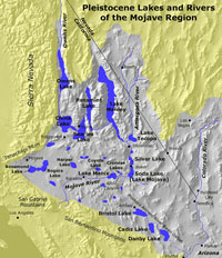
Fig. 195. Ancient lakes and Rivers of the Mojave Desert region.
|
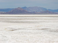 Fig. 196. Soda Dry Lake near Baker, California. Fig. 196. Soda Dry Lake near Baker, California. |
Death Valley
Death Valley National Park is along the west side of the Great Basin in southern California in the transition zone to the Mojave Desert Province (it has characteristics of both regions. The deep valley is located in the rainshadow region of the Sierra Nevada Range and is typically averages among the hottest and driest place in North America (Figures 197 to 200). The name Badwater has been assigned to the salt pan located in southern Death Valley—the lowest spot in North America with an elevation of -282 feet. In contrast, Telescope Peak, the highest peak of the Panamint Range adjacent to Death Valley, has an elevation of 11,043 feet. Parts of Death Valley are also considered as part of Mojave Desert Province. |
 |
 |
 |
 |
| Fig. 197. Dantes View in the Funeral Range gives a good view of Death Valley in Death Valley National Park, California. |
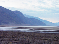
Fig. 198. Badwater (elevation -282 feet) is next to the Funeral Range in Death Valley is the lowest place in North America. |
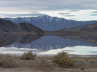
Fig. 199. Panamint Playa with Panamint Dunes and Hunter Mountain in Death Valley National Park, California. |
Fig. 200. Racetrack Playa in the Cottonwood Mountains, Nelson Range next to Saline Valley in the distance. |
|
| Lake Mead National Recreation Area encompasses lands along the Colorado from below Grand Canyon National Park to Bullhead City Arizona (Figures201 to 204). Lake Mead is the reservoir behind Hoover Dam, a 726-foot tall dam constructed in 1931-1936 during the Great Depression. The dam was built in upper Black Canyon. Below Black Canyon the Colorado flows into Lake Mojave, the reservoir for behind Parker Dam, constructed in 1934-1938. |
 |
 |
 |
 |
| Fig. 201. Uplifted sedimentary rock layers along the eastern margin of the Great Basin along the Colorado River west of the Grand Canyon. |
Fig. 202. The Colorado River has carved Black Canyon in Black Mountains volcanic complex of Tertiary age. |
Fig. 203. Hoover Dam in Black Canyon along the Colorado River, located south of Las Vegas in the Lake Mead National Recreation Area. |
Fig. 204. Lake Mojave on the Colorado River between Arizona and Nevada south of Las Vegas and north of Bullhead City, AZ. |
|
Mojave National Preserve
The Mojave National Preserve encompasses a large portion of the Mojave Desert region in southern California. The preserve has a great variety of landscape features (Figure 205 to 210). Cinder Cone National Geologic Landmark is within the preserve, a cinder cone within the Cima Volcanic Field. The Providence Mountains are composed of a thick sequence of Paleozoic-age formations (mostly limestone and dolomite) of the ancient North American continental margin basin. Kelso Dunes is a massive dune field that formed down wind from the deposits of the Mojave River and ancient Lake Mannix (in the Soda Lake basin area). The Granite Mountains are part of a massive igneous batholith similar in age and origin to the Sierra Nevada (about 180 to 80 million years). Cima Dome is a massive landscape feature that stands out along Interstate 15 between Baker CA and Las Vegas. It is a massive granitic mountain that has eroded down over many millions of years to a nearly perfect symmetrical pediment surface.
|
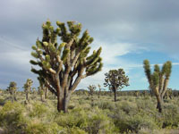
Fig. 205. A Joshua Tree forest on Cima Dome in the Mojave National Preserve, California. |
 |
 |
 |
 |
| Fig. 206. Cinder Cone National Natural Landmark in the Mojave National Preserve, southern California. |
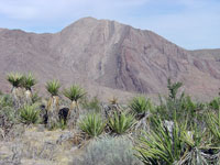
Fig. 207. Early Paleozoic sedimentary rocks crop out in the Providence Mountains within the Mojave National Preserve, California. |
Fig. 208. Kelso Dunes in the Mojave National Preserve, one of many large dune fields in the desert regions of southern California. |
Fig. 209. Spheroidally-weathering boulders in the Granite Mountains within the Mojave National Preserve. |
|
| Fig. 210. Cima Dome in the Mojave National Preserve is a 1,500 foot high granitic mountain that has eroded down to its nearly perfectly symmetrical pediment surface. It is host to the most extensive forest of Joshua Trees in the region. |
|
Joshua Tree National Park
“High Desert” regions in the Mojave Desert are above elevations of about 2,000 feet, and are expressed by the presence of indicator plants: Joshua Trees (Yucca brevifolia) (most common in elevations 5,000 to 7,000 feet) (Figure 211). “Low Desert” below 2,000 feet are part of the Sonoran Desert ecosystem, mostly limited to the south and along the lower Colorado River valley.
Whereas Joshua Trees are an indicator plant for the "High Desert", Teddy Bear Cholla (Cylindropuntia bigelovii) , the indicator plant for the "Low Desert" in the Mojave Desert region (most common between 1,000 to 3,000 feet) (Figure 212).
Joshua Tree National Park located in the Little San Bernardino Mountains, an uplifted plateau region along the eastern margin of the Mojave Desert Province bordering the Colorado Desert. High parts of the plateau are above 5,000 feet (the highest point, Quail Mountain, elevation 5,813 feet). Joshua Tree National Park is a famous destination for rock climbers—there are cliffs and boulder piles consisting hard granite scattered throughout the park (Figures 213 and 214). Figure 215 illustrates an exfoliating granite pluton on the northeast flank of Ryan Mountain. Domes like this in the park are remnants of Mesozoic-age molten rock material that melted or injected its way upward into more ancient bedrock of gneiss and schist. As the mountains rose, erosion kept pace, stripping away perhaps miles of rock, exposing the plutons.
The Little San Bernardino Mountains are on the east side of the Coachella Valley, rift valley of the San Andreas Fault (Figure 216). In contrast to the high ranges along the margins, the Coachella Valley is quite low—Palm Springs, California is below 500 feet, and the Salton Sea to the south is -226 feet (and falling as it dries up). The Coachella Valley and Salton Sea are part of the Colorado Desert Province. |
 Fig. 211. A Joshua Tree in Joshua Tree National Park, southern California. Fig. 211. A Joshua Tree in Joshua Tree National Park, southern California.
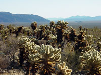 Fig. 212. A Teddy-Bear Cholla forest in Pinto Basin in Joshua Tree National Park. Fig. 212. A Teddy-Bear Cholla forest in Pinto Basin in Joshua Tree National Park.
|
 |
 |
 |
 |
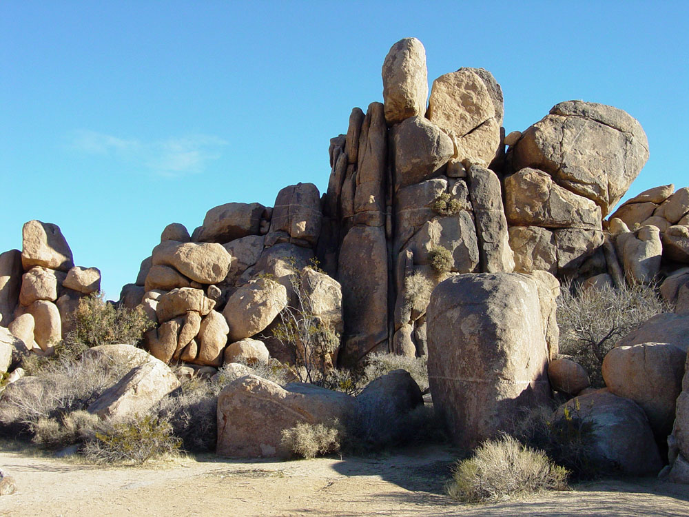
| Fig. 213. Piles of large granite boulders occur throughout Joshua Tree National Park are a popular destination for rock climbers. |
Fig. 214. Boulder piles (eroded tops of granite plutons) rise above a pediment surface in Lost Horse Valley in Joshua Tree National Park. |
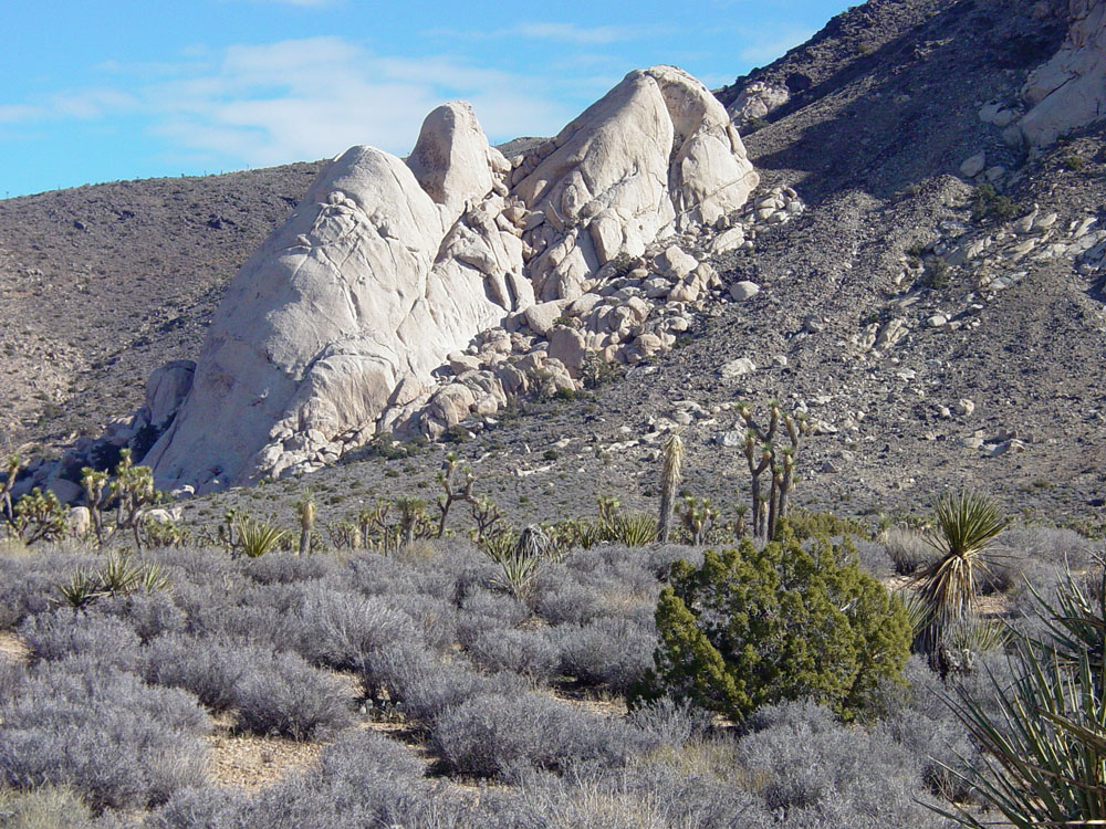
Fig. 215. An exfoliating granite pluton of Mesozoic age rises above surrounding softer eroding bedrock on Ryans Peak in Joshua Tree NP. |
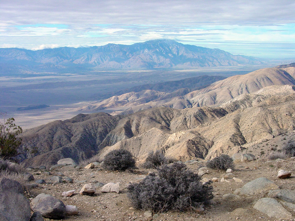
Fig. 216. Coachella Valley and San Jacinto Peak as seen from Keyes View (looking north) in Joshua Tree National Park, CA. |
|
| https://gotbooks.miracosta.edu/geology/regions/mojave_desert.html 1/20/2017 |

|
 |
|
|
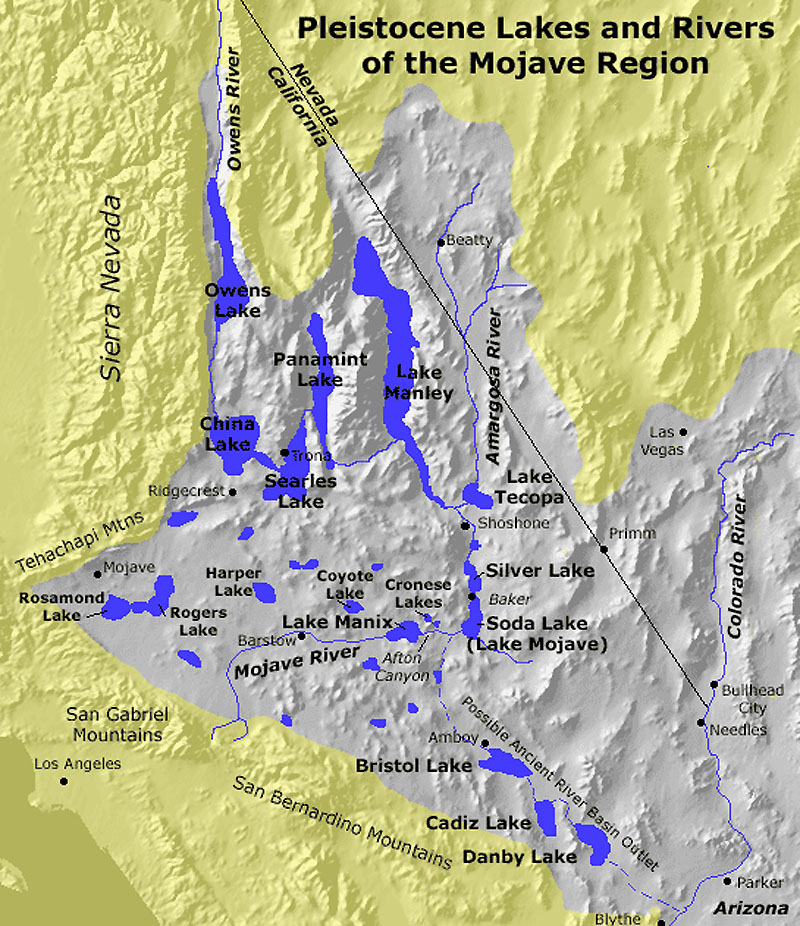
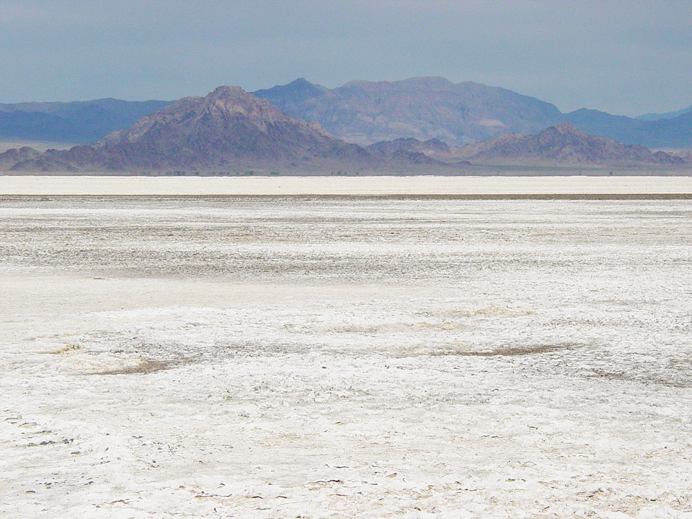 Fig. 196. Soda Dry Lake near Baker, California.
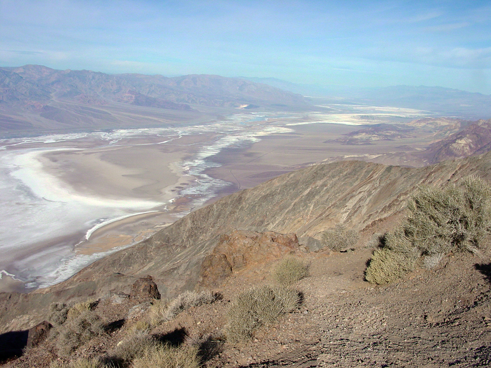
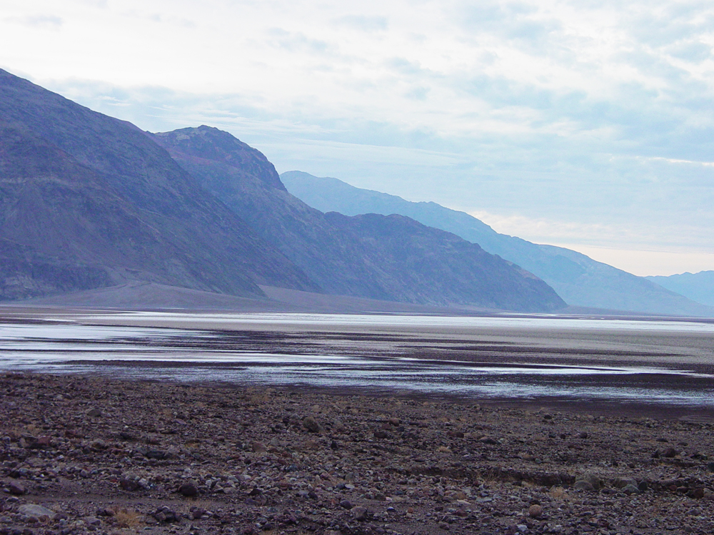
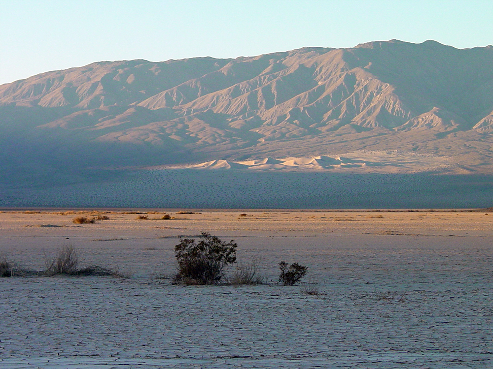


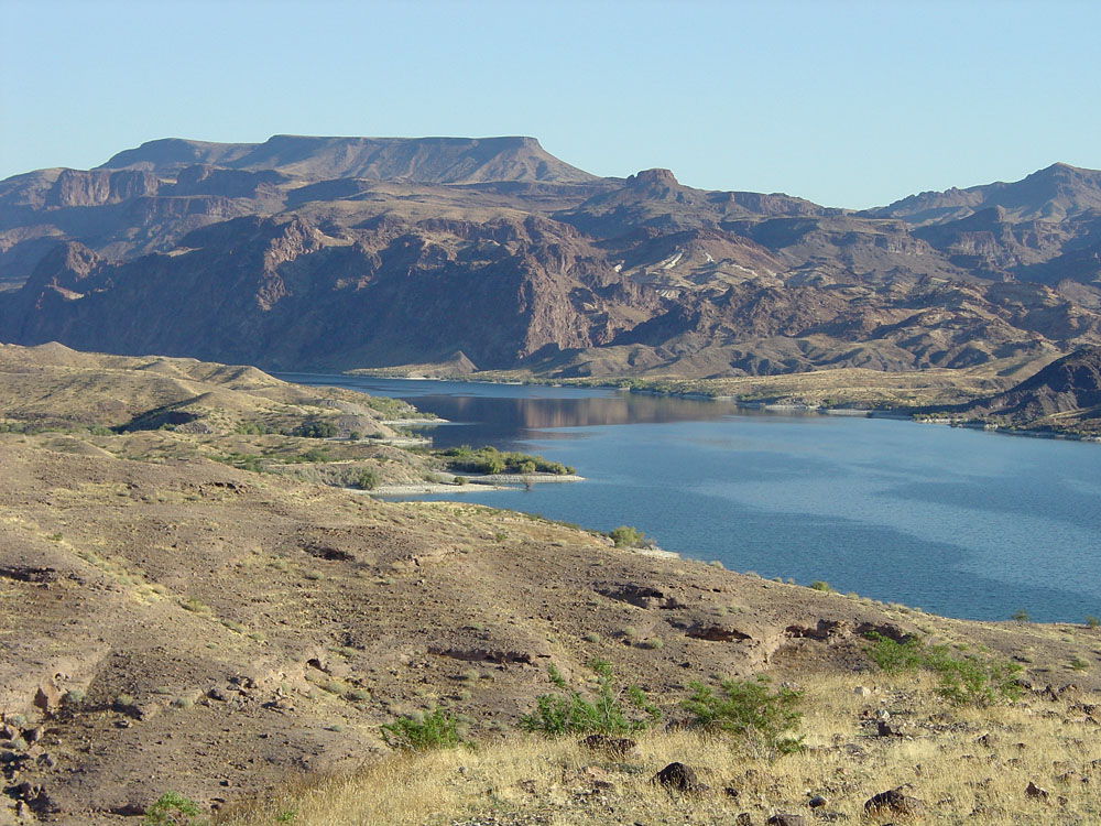
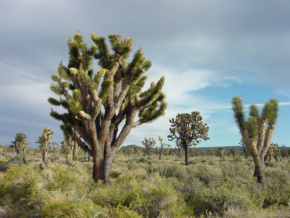
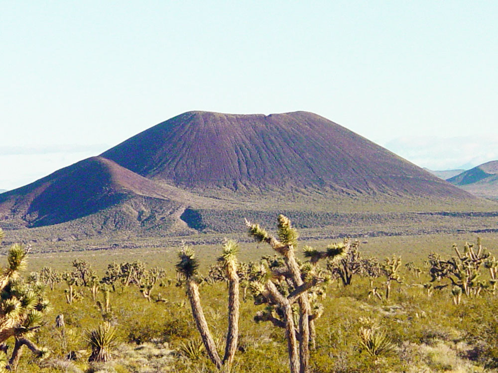
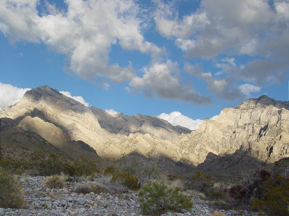
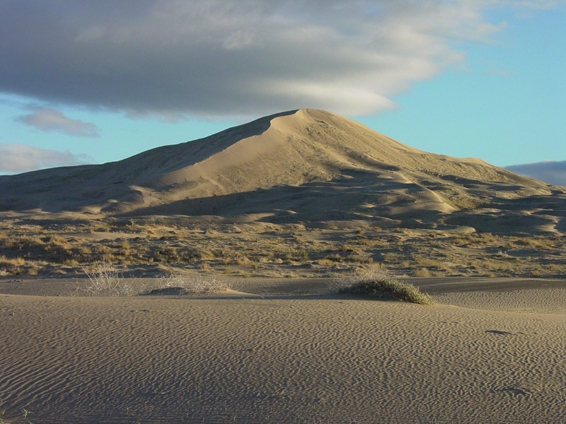
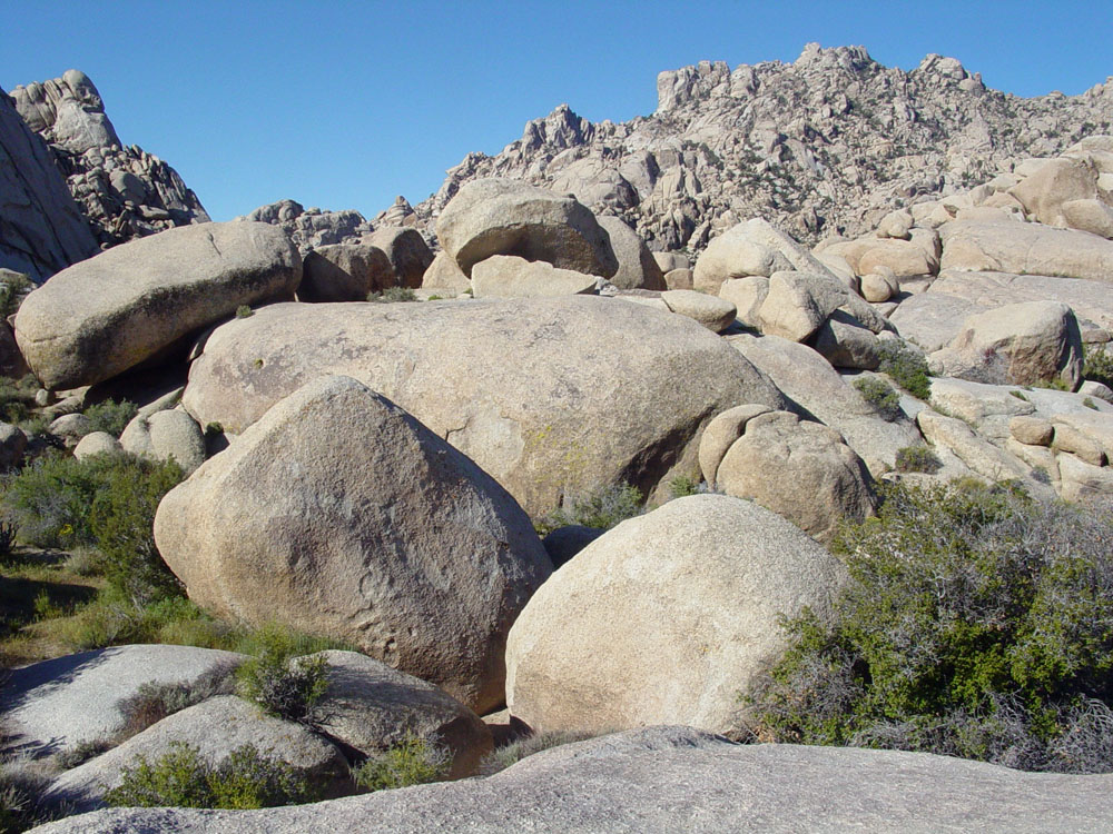
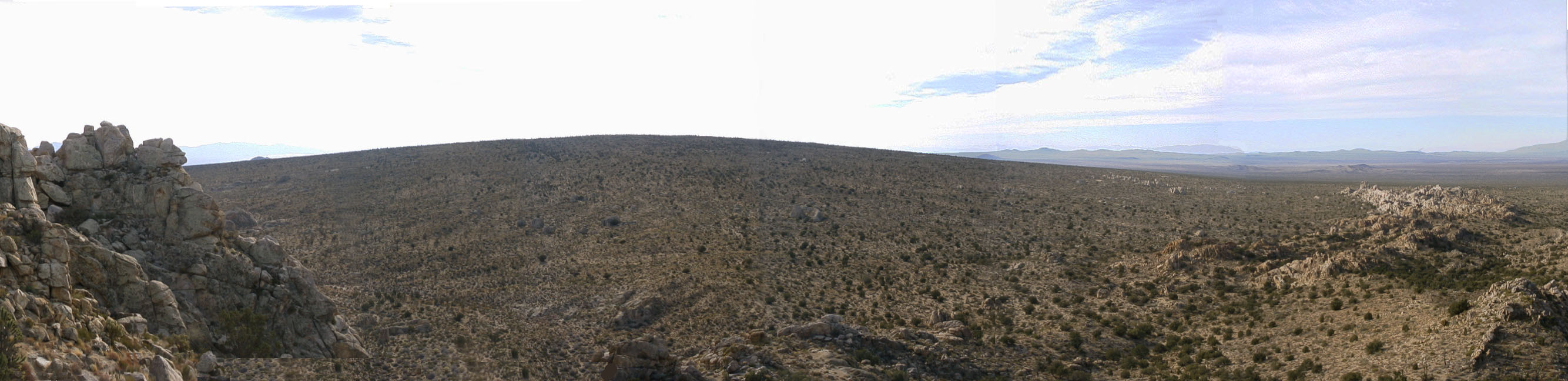
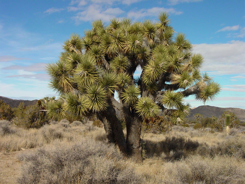 Fig. 211. A Joshua Tree in Joshua Tree National Park, southern California.
  Fig. 212. A Teddy-Bear Cholla forest in Pinto Basin in Joshua Tree National Park.